


68 Things to do near Bridal Veil Picnic Area
first prev 1 2 3 4 next lastShowing results within 50 miles Distance miles of Bridal Veil Picnic Area near Pollock Pines City, Zip, or Address

Gold Ridge Forest
Pollock Pines, California
4.4 miles WA very technical private disc golf course through oaks and pines with uphill and downhill holes — dual tees make 18, and you'll need to contact Bryan for access.
Disc Golf

Pioneer Park
Somerset, California
16.1 miles SWA free recreational disc golf course in a flat wooded area near wineries and mountain scenery in Somerset, California — with a playground, horse arena, and community center nearby.
Disc Golf
Lions Park
Placerville, California
16.1 miles WA free disc golf course in a Placerville park with tennis courts, playground, ball fields, and alternate pins — first-time players will need a guide to navigate the layout.
Disc Golf
Finnion Lake
Placerville, California
17.1 miles WA reservoir-circling course with water on three holes, a shorter technical front 8, a longer open back, and a 750-foot hole 9 — camping right next to the course.
Disc Golf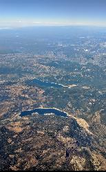
Hell Hole Reservoir
Georgetown
20.7 miles NA 4,630 foot Rubicon River reservoir in the Eldorado National Forest, 51 miles and two hours east of Georgetown, where the boat ramp cove is the only drivable shoreline and the lake drops over 100 feet by September.
Camp, Canoe, Hike, Kayak, Swim
Georgetown School Disc Golf Course
Georgetown, California
21.0 miles NWA beautiful and short free disc golf course on school grounds in Georgetown, California.
Disc Golf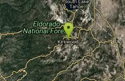
Kirkwood Mountain Resort
Kirkwood, California
23.3 miles EOpen late June through October along the Sierra Crest at 7,800-foot base elevation — hike through old growth, over creeks, and across open meadows while throwing disc.
Disc Golf 0.4 mi
Glen Alpine Falls
South Lake Tahoe, California
23.5 miles EA roadside waterfall near Lake Tahoe — wider than it is tall — with roadside parking, a scenic overlook, and the option to scramble down the rocks for a closer look.
Hike
Mollie Joyce Park Disc Golf Course
Pioneer, California
23.7 miles SChallenging disc golf through hills, trees, and scrub near Pioneer — a tough, natural course that demands all your shots.
Disc Golf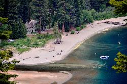
Vikingsholm Beach
South Lake Tahoe
24.0 miles NESandy beach at the head of Emerald Bay in Emerald Bay State Park, below the 1929 Vikingsholm mansion, reached by a steep one-mile trail. Free to walk in; parking is $10 a day.
Hike, Kayak, Swim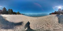
Lester Beach
South Lake Tahoe
26.1 miles NELester Beach is the sandy main swim beach at D. L. Bliss State Park on Lake Tahoe's west shore, with clear, cold, shallow water and a $10 per vehicle day-use fee in season.
Camp, Canoe, Hike, Kayak, Swim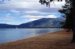
Pope Beach
South Lake Tahoe
27.1 miles NEA long sandy Forest Service beach on Lake Tahoe's south shore, three miles northwest of South Lake Tahoe, with clear, cold water and a $10 per vehicle day-use fee.
Kayak, Swim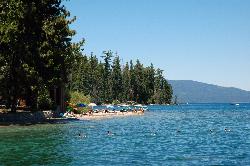
Sugar Pine Point Beach
Tahoma
28.1 miles NEA quarter-mile walk from the parking lot puts you on a sand beach at the foot of Ed Z'berg Sugar Pine Point State Park, where General Creek meets Lake Tahoe and the water runs clear enough to read the bottom. It is also genuinely cold, even in August.
Camp, Hike, Kayak, Swim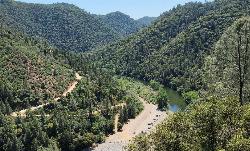
Upper Lake Clementine
Auburn
29.8 miles NWA cobble beach at the head of Lake Clementine in Auburn State Recreation Area, reached by a steep dirt road off Foresthill Road. $10 per vehicle, open mid-April to mid-October, with weekend reservations required in summer.
Canoe, Kayak, Swim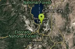
Bijou Community Park
South Lake Tahoe, California
30.0 miles EVaried disc golf fairways through 100-foot pines, open mountain meadows, and three seasonal pond hazards near Lake Tahoe.
Disc Golf
South Lake Tahoe Skatepark
South Lake Tahoe, California
30.0 miles ESkateboard near South Lake Tahoe, California
Skateboard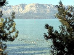
El Dorado Beach
South Lake Tahoe
30.0 miles NEFree city beach at Lakeview Commons on Lake Tahoe's south shore in South Lake Tahoe, with a roped swim area, free parking, kayak rentals and a boat ramp. Shoreline construction can close it, so check before you go.
Canoe, Kayak, Swim 5.6 mi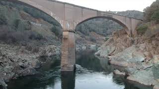
Quarry Trail
Cool, California
30.7 miles WA riverside hike along an old limestone railway line to a dramatic amphitheater quarry — wildflowers peak April through June, and the historic railway story (scrap metal for WWII) adds a fascinating layer.
Hike
William Kent Beach
Tahoe City
31.3 miles NEA free Forest Service swim beach on Lake Tahoe's West Shore, two miles south of Tahoe City on Highway 89, with a pebbly shore, cold clear water and picnic tables across from William Kent Campground.
Kayak, Swim
American River Confluence
Auburn, California
31.3 miles WThe Confluence — where the North and Middle Forks of the American River meet below Foresthill Bridge — is Auburn's favorite swimming and rafting hub.
Hike, Horseback, Kayak, Rock Climb, Swim, Whitewater


