


Bridal Veil Picnic Area
Pollock Pines

Camp and Swim
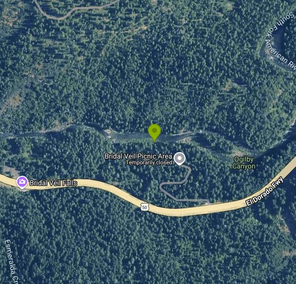
Bridal Veil Picnic Area is a U.S. Forest Service day-use site and group camp on the South Fork of the American River in the Eldorado National Forest, managed by the Placerville Ranger District. The Forest Service lists the full site as the Bridal Veil Group Campsite and Picnic Area. It sits at about 3,200 feet in a canyon of mixed conifers, on the north side of U.S. Highway 50 roughly 17 miles east of Placerville and about 5.5 miles east of Pollock Pines. The river runs along the north edge of the picnic ground, and both the Forest Service and Recreation.gov point to two large swimming holes here that draw a steady local crowd in summer.
To get there, drive Highway 50 east from Placerville for about 17 miles and turn north off the highway into the site, which drops down to the river from the eastbound side. Parking is first come, first served in the day-use area. The separate group site on the hill above the river has its own lot of seven stalls and is reserved through Recreation.gov. Turning across a divided four-lane highway takes patience on busy summer weekends, so come early.
Swimming is in the natural pools of the river below the picnic tables. There is no constructed beach, no roped area and no lifeguard, and the Forest Service does not publish depths. This stretch of the South Fork is fed by Sierra snowmelt, so expect cold water even in July, and much stronger, faster current in late spring and early summer when the snowpack is melting. Rafters and kayakers also use this part of the river. Check the flow before getting in, keep children within reach, and avoid jumping into pools you have not checked for rocks.
The day-use fee is $10, set by the Forest Service on its Eldorado fee schedule, so this is not a free site. Group campers pay $105 per night for up to 30 people and may use the day-use areas at no extra charge. The Forest Service lists day-use hours as sunrise to sunset, while the Recreation.gov listing says the gate closes at 8 p.m. and does not open until 10 a.m. The site is seasonal, with a host on site from about mid-May through mid-October. Confirm opening dates with the Placerville Ranger District at (530) 644-2324 before a spring trip.
Bears are active around the site, and food, soap and trash have to go in the bear boxes. There is no drinking water, so bring your own. Toilets are vault style, and the Forest Service notes that the site is not wheelchair accessible. Campfires may be banned during fire restrictions, and fireworks are always prohibited on national forest land.
The day-use area has about 30 picnic units with grills, and anglers fish the river here for rainbow and brown trout. The group camp has five tent pads, eight picnic tables, serving tables and a large fire ring. Bridal Veil Falls, a roadside waterfall on Highway 50, is a few minutes away, and Jenkinson Lake at Sly Park and the Crystal Basin reservoirs are each within about half an hour.
More Information
Bridal Veil Group Area And Picnic Ground, Eldorado National Forest - Recreation.gov
Explore Bridal Veil Group Area And Picnic Ground in Eldorado National Forest, California with Recreation.gov. Bridal Veil Group Campsite and Picnic Area is located on the South Fork of the American River. It offers picnicking sites, a group overnight area, beautiful sw
https://www.recreation.gov/camping/campgrounds/251615Bridal Veil Group Area And Picnic Ground, Eldorado National Forest - Recreation.gov
Explore Bridal Veil Group Area And Picnic Ground in Eldorado National Forest, California with Recreation.gov. Bridal Veil Group Campsite and Picnic Area is located on the South Fork of the American River. It offers picnicking sites, a group overnight area, beautiful sw
https://www.recreation.gov/camping/poi/251615Eldorado National Forest | Bridal Veil Group Campground | Forest Service
Bridal Veil Group Campsite and Picnic Area is located on the South Fork of the American River. It offers picnicking sites, a group overnight area, beautiful swimming holes, and close access to fishing.Day UseFees and Passes
https://www.fs.usda.gov/r05/eldorado/recreation/bridal-veil-group-campgroundEldorado National Forest | Highway 50 Corridor Area | Forest Service
Enjoy the historic Pony Express Trail and the South Fork of the American River running alongside U.S. Highway 50 and offering waterfalls and climbing — along with camping, hiking, swimming, skiing, mountain biking, and fishing.
https://www.fs.usda.gov/r05/eldorado/recreation/highway-50-corridor-areaEldorado National Forest | Picnicking | Forest Service
Day Use Areas Recreation Opportunity GuideEnjoy a day in the forest away from the rush of the city. Bring a lunch, wade in a icy cold creek or take a day hike. Picnic sites throughout the forest await you. Some campgrounds permit picnicking in campsites at no charge. Please read the information posted at the campground entrance to avoid picnicking in prohibited areas. Some popular locations for Picnicking and Day Use are listed below.PACIFIC RANGER DISTRICT - CRYSTAL BASIN AREA
https://www.fs.usda.gov/r05/eldorado/recreation/opportunities/picnicking
- Plan Ahead and Prepare
- Travel & camp on durable surfaces
- Dispose of waste properly
- Leave what you find
- Minimize campfire impacts
- Respect wildlife
- Be considerate of other visitors
Directions
From Pollock Pines
- Head southeast on Laurel Dr toward Maple Ave (144 ft)
- Turn left onto Pony Express Trail (0.6 mi)
- Turn right onto Sly Park Rd (0.2 mi)
- Turn left to merge onto US-50 E/
El Dorado Fwy (5.7 mi) - Turn left (0.3 mi)


Other Swimming Holes Nearby
Hell Hole Reservoir
Georgetown
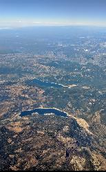
20.7 miles NA 4,630 foot Rubicon River reservoir in the Eldorado National Forest, 51 miles and two hours east of Georgetown, where the boat ramp cove is the only drivable shoreline and the lake drops over 100 feet by September.
Camp, Canoe, Hike, Kayak, Swim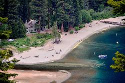
Vikingsholm Beach
South Lake Tahoe
24.0 miles NESandy beach at the head of Emerald Bay in Emerald Bay State Park, below the 1929 Vikingsholm mansion, reached by a steep one-mile trail. Free to walk in; parking is $10 a day.
Hike, Kayak, Swim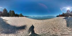
Lester Beach
South Lake Tahoe
26.1 miles NELester Beach is the sandy main swim beach at D. L. Bliss State Park on Lake Tahoe's west shore, with clear, cold, shallow water and a $10 per vehicle day-use fee in season.
Camp, Canoe, Hike, Kayak, Swim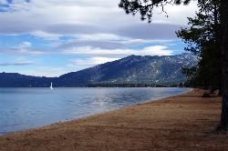
Pope Beach
South Lake Tahoe
27.1 miles NEA long sandy Forest Service beach on Lake Tahoe's south shore, three miles northwest of South Lake Tahoe, with clear, cold water and a $10 per vehicle day-use fee.
Kayak, Swim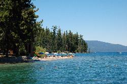
Sugar Pine Point Beach
Tahoma
28.1 miles NEA quarter-mile walk from the parking lot puts you on a sand beach at the foot of Ed Z'berg Sugar Pine Point State Park, where General Creek meets Lake Tahoe and the water runs clear enough to read the bottom. It is also genuinely cold, even in August.
Camp, Hike, Kayak, Swim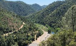
Upper Lake Clementine
Auburn
29.8 miles NWA cobble beach at the head of Lake Clementine in Auburn State Recreation Area, reached by a steep dirt road off Foresthill Road. $10 per vehicle, open mid-April to mid-October, with weekend reservations required in summer.
Canoe, Kayak, Swim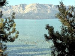
El Dorado Beach
South Lake Tahoe
30.0 miles NEFree city beach at Lakeview Commons on Lake Tahoe's south shore in South Lake Tahoe, with a roped swim area, free parking, kayak rentals and a boat ramp. Shoreline construction can close it, so check before you go.
Canoe, Kayak, Swim
William Kent Beach
Tahoe City
31.3 miles NEA free Forest Service swim beach on Lake Tahoe's West Shore, two miles south of Tahoe City on Highway 89, with a pebbly shore, cold clear water and picnic tables across from William Kent Campground.
Kayak, Swim
American River Confluence
Auburn, California
31.3 miles WThe Confluence — where the North and Middle Forks of the American River meet below Foresthill Bridge — is Auburn's favorite swimming and rafting hub.
Hike, Horseback, Kayak, Rock Climb, Swim, Whitewater 1.2-2.7 mi
Lake Clementine Trail Loop
Auburn, California
31.4 miles WFour connected trails loop around Lake Clementine on the North Fork American River — wheelchair accessible, pet friendly, and great for fishing, camping, and family summer outings.
Camp, Canoe, Hike, Kayak, Mountain Bike, Swim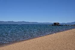
Nevada Beach Campground
Zephyr Cove
32.1 miles NEA mile of wide, coarse granite sand on the Nevada shore of Lake Tahoe, with a long shallow shelf that makes it one of the easiest big beaches on the lake to swim from. The Forest Service concessionaire charges a per vehicle day use fee at the Elks Point R
Camp, Hike, Kayak, Swim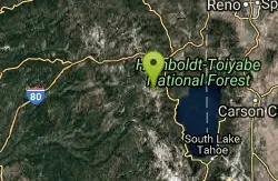
Tahoe Area
Olympic Valley, California
32.2 miles NSwim near Olympic Valley, California
Swim 4.1 mi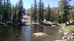
Shirley Lake Canyon Trail
Olympic Valley, California
32.5 miles NEA 2.5-mile hike from Squaw Valley Village past streams and waterfalls to a pure Sierra lake — rocky near the top, with a free gondola ride back down from High Camp as a reward.
Hike, Swim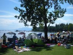
Commons Beach
Tahoe City
33.4 miles NEFree public beach and lakefront park in downtown Tahoe City on Lake Tahoe, run by the Tahoe City PUD, with cold clear water, a sand and cobble shore, kayak rentals and free summer concerts.
Kayak, Swim
Zephyr Cove Park
Glenbrook, Nevada
33.6 miles NESix tennis courts, disc golf, a sledding hill, a beach, and a fishing pond all at one free park make Zephyr Cove one of Lake Tahoe's most versatile family hangouts.
Camp, Canoe, Disc Golf, Hike, Horseback, Kayak, Swim
Lake Forest Beach
Tahoe City
34.7 miles NEA free public beach at the end of Bristlecone Street, owned by Placer County and run by the Tahoe City Public Utility District. Sandy, pine shaded and genuinely quiet, with the one real constraint being how few cars fit at the end of the road.
Camp, Canoe, Kayak, Swim
Granite Bay Main Beach
Granite Bay, California
35.6 miles WThe largest sand beach on Folsom Lake, guarded in summer, twenty five minutes from downtown Sacramento at the end of Douglas Boulevard.
Canoe, Hike, Kayak, Swim
North Fork Falls
Colfax, California
35.7 miles NClear water, cliff-jumping pools, and waterfalls at Sierra Nevada's North Fork Falls — a summer hike to two deep pools with 10-to-25-foot cliffs ready for leaping.
Camp, Hike, Swim
Heath Falls Overlook Trail
Truckee, California
37.0 miles NHike and Swim near Truckee, California
Hike, Swim
Palisades Creek Trail
Truckee, California
37.0 miles NA difficult Sierra Nevada trail past Palisade Falls — one of the tallest on the American River — with views of Devils Peak, alpine lakes, and 2,000 feet of elevation gain.
Hike, SwimNearby Campsites
Hell Hole Reservoir
Georgetown
20.7 miles NA 4,630 foot Rubicon River reservoir in the Eldorado National Forest, 51 miles and two hours east of Georgetown, where the boat ramp cove is the only drivable shoreline and the lake drops over 100 feet by September.
Camp, Canoe, Hike, Kayak, Swim
Lester Beach
South Lake Tahoe
26.1 miles NELester Beach is the sandy main swim beach at D. L. Bliss State Park on Lake Tahoe's west shore, with clear, cold, shallow water and a $10 per vehicle day-use fee in season.
Camp, Canoe, Hike, Kayak, Swim
Sugar Pine Point Beach
Tahoma
28.1 miles NEA quarter-mile walk from the parking lot puts you on a sand beach at the foot of Ed Z'berg Sugar Pine Point State Park, where General Creek meets Lake Tahoe and the water runs clear enough to read the bottom. It is also genuinely cold, even in August.
Camp, Hike, Kayak, Swim 1.2-2.7 mi
Lake Clementine Trail Loop
Auburn, California
31.4 miles WFour connected trails loop around Lake Clementine on the North Fork American River — wheelchair accessible, pet friendly, and great for fishing, camping, and family summer outings.
Camp, Canoe, Hike, Kayak, Mountain Bike, Swim
Nevada Beach Campground
Zephyr Cove
32.1 miles NEA mile of wide, coarse granite sand on the Nevada shore of Lake Tahoe, with a long shallow shelf that makes it one of the easiest big beaches on the lake to swim from. The Forest Service concessionaire charges a per vehicle day use fee at the Elks Point R
Camp, Hike, Kayak, Swim
Zephyr Cove Park
Glenbrook, Nevada
33.6 miles NESix tennis courts, disc golf, a sledding hill, a beach, and a fishing pond all at one free park make Zephyr Cove one of Lake Tahoe's most versatile family hangouts.
Camp, Canoe, Disc Golf, Hike, Horseback, Kayak, Swim
Lake Forest Beach
Tahoe City
34.7 miles NEA free public beach at the end of Bristlecone Street, owned by Placer County and run by the Tahoe City Public Utility District. Sandy, pine shaded and genuinely quiet, with the one real constraint being how few cars fit at the end of the road.
Camp, Canoe, Kayak, Swim
North Fork Falls
Colfax, California
35.7 miles NClear water, cliff-jumping pools, and waterfalls at Sierra Nevada's North Fork Falls — a summer hike to two deep pools with 10-to-25-foot cliffs ready for leaping.
Camp, Hike, Swim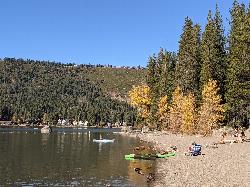
China Cove Beach
Truckee
40.2 miles NChina Cove Beach is the sandy, shallow corner at the west end of Donner Memorial State Park, on the south shore of Donner Lake outside Truckee. California State Parks runs it, access is open to anyone paying the 10 dollar day use parking fee, and there is
Camp, Canoe, Hike, Kayak, Swim
New Hogan Lake
Valley Springs, California
44.6 miles SWNew Hogan Lake is a 4,400-acre reservoir tucked into the golden Sierra Nevada foothills of Calaveras County, California, about 30 miles northeast of Stockton near the little town of Valley Springs....
Backpack, Camp, Hike, Swim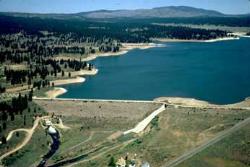
Boca Reservoir Hidden Beach
Truckee, California
49.8 miles NESandy informal beaches on the northeast shore of Boca Reservoir above Truckee, free to use, windy in the afternoons, and drawn down hard by the end of summer.
Camp, Canoe, Kayak, Kiteboard, Swim


