


180 Things to do near Civil Defense Caves
first prev 1 2 3 4 5 6 7 8 9 next lastShowing results within 50 miles Distance miles of Unnamed Road, St Anthony, ID 83445, USA City, Zip, or Address

Aldous Lake and Hancock Lake
Kilgore, Idaho
24.5 miles NA pair of alpine lakes near Kilgore, Idaho. Good road all the way to the trailhead. Easy to moderate 1.5mi hike to the first lake (Aldous) and another mile of moderate hiking to Hancock. Beautiful...
Backpack, Camp, Hike, Horseback, Swim 0.1 mi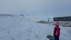
Founder's Square Hill (Under the Water Tower)
Rexburg, Idaho
24.6 miles SThis is a great sledding hill. It's about the perfect steepness and really wide. It's also big enough to make it worth a little run on a snowboard or an inner tube. While this is a pretty...
Sled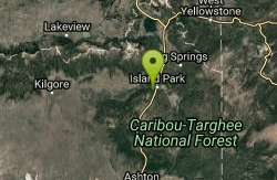
Box Canyon Island Park
Island Park, Idaho
26.0 miles NEThe Box Canyon Campground is situated on the canyon rim above the Henry's Fork of the Snake River. There are 16 single and 2 double units, each having tent and camper pads, fire rings, grills...
Canoe 5.8 mi
Box Canyon Trail
Island Park, Idaho
26.0 miles NEVarious species of tress and wildflowers can be seen on the trail, as well as songbirds, waterfowl and occasional wildlife. The trail is open for the following uses: Motorcycle Trail Riding, Off...
Hike, Mountain Bike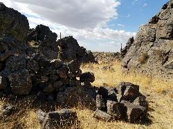
Rattle Rock / The Gauntlet
Menan, Idaho
26.3 miles SWRattle Rock is a much different arena than the flat or even hilly woods associated with rec ball or wooden scrap barriers like many established fields. You won't find any trees, spools, or straw...
Airsoft, Paintball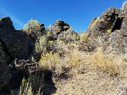
Lava Hill
Menan, Idaho
26.6 miles SWThis is a great little spot. Each team starts at one side of the collapsed lava tube. You can see each other really well from that point. Then you take the hill and get the other guys off it. It...
Airsoft, Paintball
Falls River, Lower Run
Ashton, Idaho
27.0 miles EFall River rises on the Madison and Pitchstone plateaus in the southwest corner of Yellowstone National Park, Wyoming and flows approximately 64 miles (103 km) to its confluence with the Henrys Fork...
Whitewater
Flat Canyon Trail
Island Park, Idaho
27.6 miles ENon-motorized use. souce: fs.usda.gov
Mountain Bike 0.9 mi
Buffalo River Campground
Island Park, Idaho
27.7 miles NEThe float here is nice and easy. It's a great early season float. Later in the season the shallow spots will force you to walk a good chunk of the float. The water is super clear and often pretty...
Camp, Canoe, Kayak, Swim 0.6-2.0 mi
North Menan Butte ('R' Mountain)
Menan, Idaho
27.7 miles SWThe North Menan Butte is more commonly known to the locals and college students as R Mountain. Many kids know it better as Ou'R' Mountain. The butte is a rare and unique geological area and provides...
Camp, Cave, Hike
Porcupine Creek
Ashton, Idaho
28.0 miles EPorcupine Creek is a hunting, fishing, camping, and swimming spot near Ashton, Idaho in Fremont County within Targhee National Forest. It's surrounded by forests, meadows, and a creek...
Camp, Swim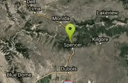
Stoddard Creek
Spencer, Idaho
28.3 miles NWStoddard Creek Campground is located just 1 mile off I-15 and 17 miles north of the town of Dubois, Idaho. Visitors come to the area to enjoy the abundance of trails, wildlife viewing opportunities...
Camp

Lorenzo Boat Ramp
Rigby, Idaho
29.5 miles SHike and Kayak near Rigby, Idaho
Hike, Kayak 1.0-1.3 mi
Lorenzo Bridge
Rexburg, Idaho
29.6 miles SThis is the old site of the Lorenzo Boat Launch, which has moved to the other side of the river a little further downstream. This spot sees very little traffic. There are beautiful, yet...
Airsoft, Hike, Paintball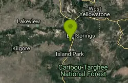
Coffee Pot Rapids Trail
Island Park, Idaho
30.7 miles NEHiker and fisherman parking is available at the campground entrance. Coffee Pot Rapids trail is 2.2 miles in length, is a non-motorized trail that follows the Henry's Fork of the Snake...
Mountain Bike
Upper Coffee Pot Campground
Island Park, Idaho
30.8 miles NEUpper Coffeepot Campground stretches along a floatable section of Henry's Fork of the Snake River. A mixed growth lodgepole pine forest provides partial shade and summer wildflowers are...
Camp, Canoe
Herbert Idaho Ghost Town
Ririe, Idaho
31.5 miles SCLOSED. Private property marked NO TRESPASSING. Herbert is a small ghost town that was operated until the 40s, but with the invention of the automobile, it was much more convenient to live in Rexburg...
Hike 7.6 mi
Mount Jefferson
Island Park, Idaho
32.0 miles NEMount Jefferson, at 10, 203 feet is the highest point in the Centennial Mountains, a small, local range on the border of Idaho and Montana a little west of Yellowstone. These mountains consist of a...
Hike 4.2 mi
Lake Marie
Island Park, Idaho
32.0 miles NELake Marie sits on the North slope of Mount Jefferson in Fremont County, Idaho. The trail to get there cuts back and forth across the Idaho Montana border 4 times. Much of the trail is fairly flat...
Backpack, Hike
Sawtell Peak Trail
Island Park, Idaho
32.0 miles NEThis trail offers great views of the valley floor, mountain peaks and wildlife. source: fs.usda.gov
Mountain Bike


