


Trout Pond Recreation Area
Lost City
Camp, Canoe, Hike, Kayak, and Swim
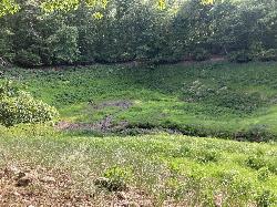
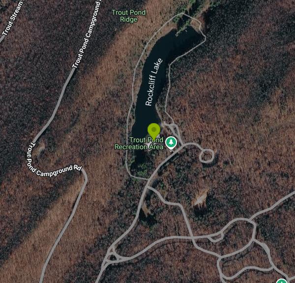
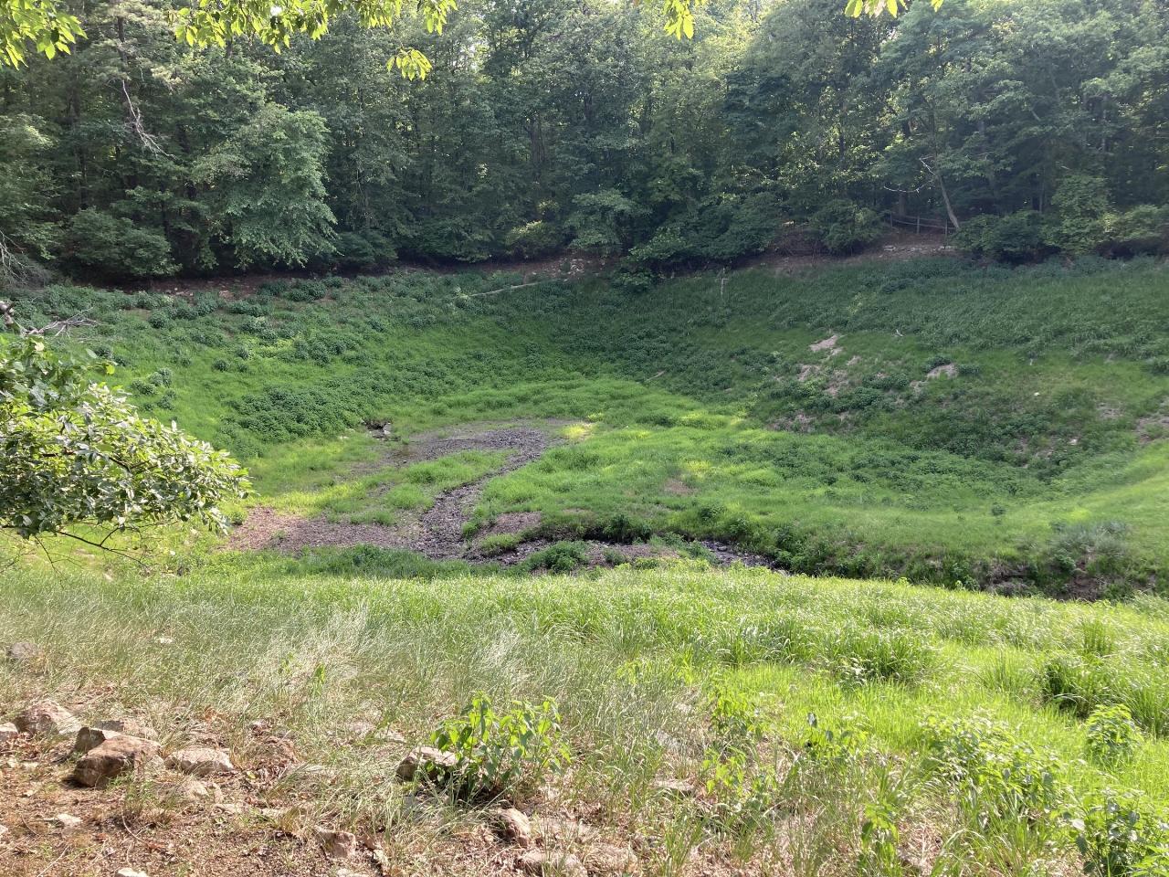
Trout Pond Recreation Area is a Forest Service day-use area and campground in the George Washington National Forest, run by the Lee Ranger District, in the hills of Hardy County about 9 km east of Lost City, West Virginia. Two lakes sit inside the gate. Rock Cliff Lake (also spelled Rockcliff) is a 17-acre reservoir on Trout Pond Run with rock cliffs along part of its shore, and it holds the sand swim beach. A short walk south is Trout Pond itself, a sinkhole lake long described as the only natural lake in the state.
From Wardensville, take Trout Run Road (WV 23/10) south for about 6 miles, turn right on Thorny Bottom Road (CR 16) for another 6 miles, then left on Forest Road 500 for one mile to the entrance station. Coming from Lost City or Broadway, Virginia, follow WV 259, turn onto CR 16 for 6 miles, then FR 500. Day-use parking is inside the gate near the beach, playground and picnic area at the south end of Rock Cliff Lake. There is no cell signal in the area, so download any maps or the Recreation.gov app before you leave pavement.
The designated swim area is in front of a white-sand beach on Rock Cliff Lake. The lake averages about 12 feet deep and reaches 36 feet at its deepest, so the bottom drops off past the shallow beach zone. It is a stream-fed mountain reservoir stocked with trout, so expect the water to feel cool even in July. Neither the Forest Service nor Recreation.gov lists lifeguards, so plan on swimming unsupervised. The day-use area also has showers, a boat ramp, 30 picnic sites and a playground. Dogs are not allowed on the beach, and alcohol is banned throughout the recreation area.
This is not free. The Forest Service charges a day-use fee of $8 per vehicle carrying up to eight people, and $2 per person for walk-ins and for vans or buses with more than eight passengers. Pay at the fee station with cash (exact change) or check in an envelope, or scan the QR code there with the Recreation.gov app. America the Beautiful Senior and Access pass holders get half off; other interagency passes are not honored. Day use runs April through December from sunrise to sunset, and the entrance gates are locked from 10 p.m. to 8 a.m. Restrooms, showers and drinking water are only on from about mid-May through October.
Gas motors are prohibited on Rock Cliff Lake, which makes it a quiet place for canoes, kayaks and small electric boats, and every boater must wear a life jacket. Trout Pond is a different story. In July 2002 a shift in the limestone beneath the sinkhole drained it nearly dry, and since then it fills only after long wet spells and empties again when the rain stops. Don't count on it for a swim, and check with the Lee Ranger District at 540-984-4101 for conditions, since the site has limited staffing. A Forest Service food storage order for bears is in effect here.
The campground has about 50 sites, some with electric hookups, open from early May through October, with reservations on Recreation.gov and some first-come sites. The Rockcliff Lake Trail (TR 1010) loops the reservoir, the Old Pond Trail leads to the sinkhole, and the longer Trout Pond Trail climbs toward Long Mountain and the Chimney Rock fin.
More Information
e-WV - Trout Pond
e-WV, the West Virginia Encyclopedia online, is the premier reference work on the Mountain State’s people, places, history, science, and culture. Check back often as it is updated regularly.
https://wvencyclopedia.org/entries/750George Washington and Jefferson National Forests | Trout Pond Recreation Area | Forest Service
Trout Pond Recreation Area is home to two beautiful lakes, Rock Cliff Lake and Trout Pond. At Rock Cliff Lake can spend time relaxing on a sandy mountain beach or fish for stocked trout while kids splash in the cool waters. Trout Pond, home to native Brook trout, is the only natural lake in West Virginia. Both lakes have designated swimming areas, and easy lakeside trails that make this a perfect family destination.
https://www.fs.usda.gov/r08/gwj/recreation/trout-pond-recreation-areaRock Cliff Lake | DIY Outdoors | West Virginia University
Home Canoeing Rock Cliff Lake Canoeing:
https://diyoutdoors.wvu.edu/canoeing/rock-cliff-lakeTrout Pond - West Virginia Explorer
Trout Pond, near Wardensville, West Virginia (WV), in Hardy County, is West Virginia's only natural lake and is situated in the Trout Pond Recreation Area.
https://wvexplorer.com/attractions/natural-wonders/trout-pond/Trout Pond Day Use Pass in Virginia - Recreation.gov
Buy Trout Pond Day Use Activity Pass in George Washington & Jefferson National Forest, Virginia with Recreation.gov. Trout Pond Recreation Area boasts two beautiful lakes: Rock Cliff Lake and Trout Pond. Relax on a sandy mountain beach or fish for stocked trout while kids spla
https://www.recreation.gov/activitypass/AP22483Trout Pond Recreation Area | DIY Outdoors | West Virginia University
Home Hiking Trout Pond Recreation Area Hiking:
https://diyoutdoors.wvu.edu/hiking/trout-pond-recreation-areaTrout Pond Recreation Area, George Washington & Jefferson National Forest - Recreation.gov
Explore Trout Pond Recreation Area in George Washington & Jefferson National Forest, Virginia with Recreation.gov. Trout Pond Recreation Area boasts two bodies of water, Rock Cliff Lake and Trout Pond. Relax on a sandy mountain beach or fish for stocked trout while relaxing
https://www.recreation.gov/camping/campgrounds/232162Be courteous, informed, and prepared. Read trailhead guidelines, stay on the trail, and don't feed the wildlife.
Read More
- Plan Ahead and Prepare
- Travel & camp on durable surfaces
- Dispose of waste properly
- Leave what you find
- Minimize campfire impacts
- Respect wildlife
- Be considerate of other visitors
Directions
From Lost City
- Head north on N Lost City Rd toward W 704 Rd (7.9 mi)
- Turn left onto State Hwy 82 N (16.2 mi)
- Turn left onto E Ferry St (0.6 mi)
- Continue onto OK-20 W/
Hwy 20 W (5.5 mi) - Turn right onto N 435 Rd/
Carbide Rd/ True Rd Continue to follow N 435 Rd/(10.5 mi)True Rd - Turn left onto W 390 Rd (0.5 mi)
- Turn right onto US-69 N (8.6 mi)
- Turn rightToll road(0.2 mi)
- Keep leftToll road(0.7 mi)
- Merge onto I-44 EToll roadEntering Missouri(337 mi)
- Merge onto I-44 E/
I-55 N (0.9 mi) - Take exit 291A to merge onto I-55 N/
I-64 E/ US-40 E toward I-70 E/ Illinois Entering Illinois(0.8 mi) - Take exit 1 to merge onto I-55 N/
I-64 E (2.3 mi) - Take exit 3 for I-64 E/
IL-3 N/ St Clair Ave toward Louisville (0.3 mi) - Continue onto I-64 E (70.8 mi)
- Merge onto I-57 S/
I-64 E (3.9 mi) - Keep left to continue on I-64 E, follow signs for LouisvillePassing through IndianaEntering Kentucky(181 mi)
- Slight right to stay on I-64 E (signs for I-71/
Lexington/ Cincinnati) (76.1 mi) - Keep left to stay on I-64 E, follow signs for Winchester/
Ashland Entering West Virginia(169 mi) - Take exit 59 for I-77 N toward I-79/
Parkersburg (0.3 mi) - Continue onto I-77 N (1.6 mi)
- Keep right to continue on I-79 N, follow signs for Clarksburg (97.8 mi)
- Take exit 99 to merge onto US-119 N/
US-33 E/ US-48 toward Buckhannon (12.1 mi) - Keep left to continue on US-33 E/
US-48 E (39.4 mi) - Slight right onto the ramp to WV-72 S (302 ft)
- Turn right onto WV-72 S (1.3 mi)
- Slight right onto Chestnut St/
Main St (292 ft) - Turn left onto 1st StPass by McDonald's (on the right)(0.4 mi)
- Continue onto US-219 N/
Pennsylvania Ave Continue to follow US-219 N(13.3 mi) - Turn right onto WV-32/
Spruce St Continue to follow WV-32(2.2 mi) - Turn left onto WV-93 E (13.0 mi)
- Continue onto US-48 (28.0 mi)
- Continue onto Richard Lee Moyers Veterans Memorial Bridge (0.4 mi)
- Continue onto US-48 (15.0 mi)
- Take the VA-259 S exit toward VA-29 S/
Baker (0.4 mi) - Turn right onto WV-259 S (0.5 mi)
- Turn left to stay on WV-259 S (7.1 mi)
- Turn left onto Mill Gap Rd (4.6 mi)
- Turn right onto Trout Pond Campground Rd (1.6 mi)
- Slight left to stay on Trout Pond Campground Rd (151 ft)
- Continue straight (0.2 mi)
- Continue straight (0.1 mi)
- Turn left (95 ft)
- Slight leftDestination will be on the left(279 ft)


Other Swimming Holes, Hiking Trails, Canoeing Areas, and Kayaking Areas Nearby

Blue Hole Bergton
Bergton, Virginia
17.6 miles SWA scenic day-use picnic area on a river in Rockingham County — flooding and erosion have made it shallower over time, best now for wading and enjoying the forest and rock surroundings.
Swim
Welton Park
Petersburg, West Virginia
19.0 miles WA beautiful 29-acre riverside park on the Potomac River with beach and dock access, kayak and canoe put-in, picnic areas, campsites, a playground, and a growing holiday light show.
Swim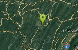
Petersburg Area
Parsons, West Virginia
19.0 miles WSwim near Parsons, West Virginia
Swim
Elizabeth Furnace
Strasburg, Virginia
22.0 miles EA recreation area in the Shenandoah with 32 electric campsites, miles of hiking and mountain biking trails, rock climbing access, and a Passage Creek swimming hole with a log to jump from.
Camp, Hike, Mountain Bike, Rock Climb, Swim
Buzzard Rock Hole
Strasburg, Virginia
23.5 miles EA cold, clear, deep swimming hole below the iconic Buzzard Rock, with a sunbathing ledge all around — just note the rocky shallow bottom makes jumping unsafe.
Hike, Swim 3.8 mi
Overall Run Falls
Overall, Virginia
24.9 miles SEVirginia's longest consecutive waterfall anchors a challenging 8-mile Shenandoah hike with rock scrambles, cool river rest spots, and a deep swimming hole for experienced swimmers.
Hike, Swim
Gooney Creek
Front Royal, Virginia
26.9 miles ECamp, Hike, and Swim near Front Royal, Virginia
Camp, Hike, Swim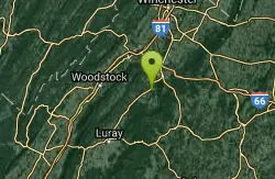
Overall Area
Crewe, Virginia
27.0 miles ESwim near Crewe, Virginia
Swim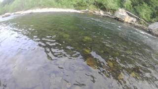
River Access Hole
Cabins, West Virginia
27.1 miles WScenic forested rock formations and the rushing North Fork South Branch of the Potomac River offer wading, swimming, fly fishing, and float access — wear foot protection in the rocky riverbed.
Canoe, Kayak, Swim, Whitewater
Big Bend
Cabins, West Virginia
27.5 miles WA sandy-beached swimming hole on the Potomac River with deep enough water for splashing and a circular current perfect for tubing — plus a campground with showers and fire pits.
Swim
Piney River
Sperryville, Virginia
30.2 miles SEMultiple swimming holes along Piney River — including one beneath a small waterfall — reached by following Cumberland Trail through the forest near Sperryville.
Hike, Swim
Nicholson Hollow Trail
Morning Star, Virginia
31.4 miles SEAn 8-mile moderately strenuous Shenandoah hike past stream crossings, small cascading waterfalls, shaded forest, and the historic Corbin Cabin — wading is possible in low-flow conditions.
Hike, Swim
Fridley Gap
Keezletown, Virginia
31.8 miles SA small, chest-deep swimming hole at the halfway point of a beautiful George Washington National Forest loop — cold all year and only 0.5 miles from the trailhead.
Hike, Swim
Red Creek
Davis, West Virginia
33.3 miles WA remote West Virginia canyon hides multiple waterfalls, natural water slides, and deep swimming pools along a 6.3-mile out-and-back through dramatic rock formations.
Camp, Hike, Kayak, Swim
Whiteoak Canyon
Syria, Virginia
33.8 miles SEA Shenandoah hike featuring both a two-tiered lower waterfall and a classic single-drop upper falls — with cool wading spots along the trail for a well-earned break before the 1,040-foot climb back.
Hike, Swim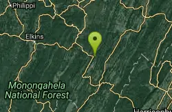
Seneca Area
Shady Spring, West Virginia
34.9 miles WSwim near Shady Spring, West Virginia
Swim
Cave Hole
Seneca Rocks, West Virginia
34.9 miles WA free, fee-free swimming hole on the North Fork South Branch Potomac River near Seneca Rocks, with blue-green water, a rocky beach, cliff reflections, and shaded alcoves — no diving.
Swim 2.8 mi
Cedar Run Falls
Oldrag, Virginia
35.0 miles SESix waterfalls, a natural waterslide, and a deep swimming hole reward experienced hikers who tackle this strenuous 8-mile, 2,794-ft-elevation Shenandoah trail.
Hike, Swim
Old Rag Area
Crewe, Virginia
35.0 miles SESix swimming holes at the base of waterfalls and along rivers in Shenandoah National Park's Old Rag area, all reached by hikes of varying length from Skyline Drive or nearby routes.
Swim 5.2 mi
Hazel River Falls
Sperryville, Virginia
35.2 miles SEA 5.3-mile moderate hike in Shenandoah National Park leading to two moss-covered waterfalls, a wading and swimming pool, flat sunbathing rocks, and small caves to explore.
Hike, SwimNearby Campsites
Elizabeth Furnace
Strasburg, Virginia
22.0 miles EA recreation area in the Shenandoah with 32 electric campsites, miles of hiking and mountain biking trails, rock climbing access, and a Passage Creek swimming hole with a log to jump from.
Camp, Hike, Mountain Bike, Rock Climb, Swim
Gooney Creek
Front Royal, Virginia
26.9 miles ECamp, Hike, and Swim near Front Royal, Virginia
Camp, Hike, Swim
Red Creek
Davis, West Virginia
33.3 miles WA remote West Virginia canyon hides multiple waterfalls, natural water slides, and deep swimming pools along a 6.3-mile out-and-back through dramatic rock formations.
Camp, Hike, Kayak, Swim
Natural Chimneys
Mount Solon, Virginia
45.4 miles SWTowering vertical limestone formations draped in trees and vines, with shallow river swimming holes, 2.5 miles of hiking and biking trails, and a well-equipped 135-site campground.
Camp, Hike, Mountain Bike, Swim
New Germany State Park
Swanton, Maryland
45.9 miles NWA mountain gem tucked between Big Savage Mountain and the Continental Divide, with ten miles of multi-use trails, a small lake for fishing and swimming, and a true off-the-grid atmosphere.
Backcountry Ski, Camp, Canoe, Cross-country Ski, Hike, Mountain Bike, Snowshoe, Swim
North River Gap
Mount Solon, Virginia
47.1 miles SWA free recreation area with an easy 2.4-mile river gorge hike through lush forest, a wading and swimming spot in the North River, and primitive campsites for $5 a night.
Camp, Hike, Swim


