


Bobsled Trail
Salt Lake City, Utah

| Address: | ~Popperton Park Way, Salt Lake City, UT 84103, USA |
| GPS: |
40°46'41.4"N 111°51'1.8"W Maps | Directions |
| State: | Utah |
| Trail Length: | 7.00 miles |
| MTB Difficulty: | Intermediate |
| Trail Type: | Network |
| MTB Trail Type: | Singletrack |
Mountain Bike
The Bobsled Trail is a famous, fast-paced biking trail that will keep your heart racing and send you flying over your handlebars if you're not vigilant. It extends from the Bonneville Shoreline Trail.
This old creekbed trail has many twists and turns with major bank turns around every corner. It is explicitly a downhill trail so don't even try to go uphill. There are so many jumps that can get your bike some incredible air!
Bobsled Trail is a super fast, technical biking trail that should only be attempted by more advanced mountain bikers.
Trail: about 1.6 miles
More Information
Bobsled
Bobsled is a singletrack mountain bike trail in Salt Lake City, Utah. View maps, videos, photos, and reviews of Bobsled bike trail in Salt Lake City.
http://www.singletracks.com/bike-trails/bobsled/Bobsled Mountain Bike Trail, Salt Lake City, Utah
A lightning fast downhill featuring sweeping turns through old creek bed and trees. Near Salt Lake City, Utah.
https://www.mtbproject.com/trail/968652/bobsledBobsled Trail (SLC Avenues) - Ultimate Guide to Mountain Biking in Utah
Bobsled off the BST in the SLC Avenues area. This is an insanely fun downhill rock ’n roll from the Bonneville Shoreline trail down to the avenues in Salt Lake. Season mid spring to late fall. Upper-intermediate technical, moderate climbing.
https://utahmountainbiking.com/trails/bobsled/Never modify trail features. Ride trails when they're dry enough that you won't leave ruts. Speak up when you see others on the trail and always yield to hikers, horses, and others coming uphill. Always ride on the established trail.
Read More
- Plan Ahead and Prepare
- Travel & camp on durable surfaces
- Dispose of waste properly
- Leave what you find
- Minimize campfire impacts
- Respect wildlife
- Be considerate of other visitors
Directions
From Salt Lake City, Utah
- Head north on Main St toward W 300 S/Broadway (0.1 mi)
- Turn right onto 300 S/Broadway (0.1 mi)
- Turn left onto S State St (0.5 mi)
- Turn right onto S Temple (1.9 mi)
- Turn left onto N Virginia St (0.6 mi)
- Turn right onto Popperton Park WayDestination will be on the left(479 ft)


Other Mountain Bike Trails Nearby
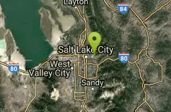
Bonneville Shoreline Trail - Northern Salt Lake City
Salt Lake City, Utah
1.4 miles SERiding the old Lake Bonneville shoreline along the Wasatch Mountains, this trail offers a great aerobic workout, rideable winters, and sweeping views of Salt Lake City.
Mountain Bike 4.7 mi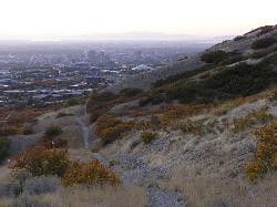
Bonneville Shoreline Trail
Salt Lake City, Utah
1.7 miles NWA multi-use trail stretching from North Salt Lake to Parley's Canyon that follows the ancient shoreline of Lake Bonneville — perfect for hiking, biking, and trail running.
Hike, Mountain Bike 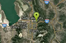
Mt. Wire
Salt Lake City, Utah
2.8 miles SEA steep, loose singletrack away from the crowds on Salt Lake City's Mt. Wire, with a roller-coaster pipeline section and a choice of returning on the Bonneville Shoreline or heading up Emigration Canyon.
Mountain Bike 
Wild Rose Trailhead Park
North Salt Lake, Utah
4.1 miles NWSeveral singletrack and downhill trails in North Salt Lake's Wild Rose park — from a beginner-friendly 2.5-mile loop to technical bermed descents — with access from the Bonneville Shoreline Trail.
Mountain Bike 
Mueller Park Trail
Bountiful, Utah
6.0 miles NSmooth buff singletrack climbs gradually for 6.5 miles through Mueller Park before rewarding mountain bikers with fast, flowy descents all the way back down.
Cross-country Ski, Hike, Mountain Bike 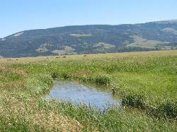
Mormon Flats
Salt Lake City, Utah
8.5 miles EA historic pioneer-trail singletrack through surreal, quiet forest with a log crossing, river crossings, and fast flat-out sections — ending at the top of Little Mountain by mountain dell reservoir.
Mountain Bike 
Mill Creek Pipeline
Salt Lake City, Utah
9.0 miles SEA connector trail system feeding into Mill Creek Pipeline near Salt Lake City — about 6.5 miles in, a sign marks the Rattlesnake downhill, which drops you near the toll booth.
Mountain Bike 
Parrish Canyon Trail
Centerville, Utah
10.0 miles NA Wasatch foothills trail connecting to Barnard Creek with views of Salt Lake City from the summit, wildlife to spot, pictographs on rocks in spring and summer, and a bridge as an easy turnaround for young hikers.
Hike, Mountain Bike 
Ferguson Canyon
Cottonwood Heights, Utah
12.0 miles SA popular climbing destination tucked between Big and Little Cottonwood Canyons, where you can hike into a shaded canyon with a stream or push on to a rocky summit for sweeping views.
Hike, Mountain Bike, Rock Climb 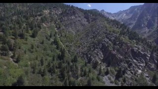
Storm Mountain
Salt Lake City, Utah
12.1 miles SEA compact Wasatch peak just 3 miles up Big Cottonwood Canyon, with rock climbing routes, hiking, biking, and Big Cottonwood Creek running right alongside the day-use area.
Hike, Mountain Bike, Rock Climb 
Glenwild
Park City, Utah
13.9 miles EAn easy-to-follow 8.4-mile mountain bike loop in Park City starting at 6,350 feet with 800 feet of elevation change — ride it clockwise for the best flow, with a cutoff option for a shorter lap.
Mountain Bike 0.8-2.0 mi
Farmington Creek trail
Farmington, Utah
14.6 miles NA multi-destination Farmington trail connecting a fishing pond, Lagoon amusement park, a small zoo with elk and bison, and scenic downtown Farmington — open to bikes, rollerblades, and foot traffic.
Hike, Mountain Bike, Skateboard 3.2 mi
Little Cottonwood Pipeline Trail
Sandy, Utah
14.8 miles SA single-track trail starting at the mouth of Little Cottonwood Canyon that stays smooth for the first mile, then gets rocky and steep — ending across a creek from historic ruins after 3.5 miles.
Mountain Bike 1.1-4.7 mi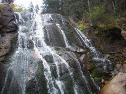
Bells Canyon
Sandy, Utah
14.9 miles SA 4.5-mile moderate hike up to a canyon waterfall through gorgeous fall foliage, meadows, wildflowers, and a creekside trail — the last 1.2 miles involve serious climbing over large rocks.
Backpack, Hike, Mountain Bike, Snowshoe 6.4 mi
Farmington Canyon
Farmington, Utah
15.0 miles NA four-season canyon road and trail system near Farmington with vibrant autumn colors, access to Francis and Bountiful Peaks, two campgrounds, and sweeping views of Kaysville and the Great Salt Lake.
Hike, Mountain Bike 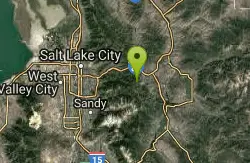
Ambush
Park City, Utah
15.1 miles EAmbush drops from near the Mid Mountain trail through Rob's and into The Canyons Ski Resort, connecting to Holly's and Rosebud Heaven for an exciting descent.
Mountain Bike 
Stealth
Park City, Utah
15.3 miles EA clockwise buff singletrack loop near Park City crossing through the Glenwild community — usually the first trail to dry out in spring with great ski area views.
Mountain Bike 
Rob's Trail
Park City, Utah
15.8 miles EA stiff pine-covered singletrack climb near Park City from Sun Peak to a saddle, connecting to Ambush for a great Canyons Resort downhill or the Mid Mountain Trail for a long ride all the way to Deer Valley.
Mountain Bike 
Rosebud's Heaven
Park City, Utah
15.8 miles EA 2.1-mile intermediate singletrack near The Canyons Ski Resort — mostly flat contour riding, then sweeping switchbacks through beautiful forest before opening into a meadow at the bottom.
Mountain Bike 
Colin's Trail
Park City, Utah
15.9 miles EA short connector trail near The Canyons Ski Resort in Park City linking to Rob's Trail and Rosebud Heaven — a handy link for longer mountain bike routes.
Mountain BikeNearby Campsites
Holbrook Trailhead
Bountiful, Utah
7.2 miles NThe Holbrook Trailhead is a popular access point for the Bonneville Shoreline Trail and Holbrook Canyon above Bountiful, Utah, on the western face of the Wasatch. Perched on the bench right at the...
Airsoft, Backpack, Camp, Paintball, Snowshoe 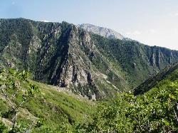
Mill Creek Canyon
Salt Lake City, Utah
9.0 miles SEAn out-and-back canyon trail with over 1,000 feet of elevation gain — the lower ski trail sees heavy traffic while the upper section above Elbow Fork stays quiet, with a reservable Yurt at the top December through April.
Camp, Cross-country Ski, Snowshoe 
Spruces Campground
Salt Lake City, Utah
14.6 miles SEA fee campground in Big Cottonwood Canyon near Salt Lake City — check USDA.gov for current rates and seasonal availability.
Camp, Sled 5.6 mi
Antelope Island Lakeside Trail
Syracuse, Utah
26.4 miles NWAn easy 2-hour loop on Antelope Island around the Great Salt Lake, with rock formations, views of the Sierra Nevadas, and the GSL — kid-friendly and good for bug fans.
Camp, Hike, Horseback 1.6-14.1 mi
Mount Timpanogas
Provo, Utah
26.4 miles SEUtah's most-climbed mountain towers 7,000 feet above the Provo valley, stretching seven miles north to south with multiple peaks over 11,000 feet — a Wasatch landmark.
Camp, Hike, Horseback, Swim 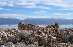
Antelope Island State Park
Syracuse, Utah
26.7 miles NWTwenty miles of trails cross Utah's Great Salt Lake island alongside free-roaming bison, antelope, and bobcats — best visited in early spring or late fall to beat the bugs.
Backpack, Camp, Hike, Horseback, Mountain Bike 2.9 mi
Pineview Reservoir
Eden, Utah
35.8 miles NA stunning Wasatch reservoir with three sandy beaches, boating, kayaking, paddleboarding, water skiing, and 18 miles of paved trail — the ultimate summer base behind the Ogden front.
Camp, Canoe, Hike, Kayak, Mountain Bike, Swim 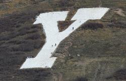
Y-Mountain Summit Trail
Provo, Utah
38.9 miles SA 1.2-mile climb east of BYU leads to a massive block Y on the hillside and sweeping panoramas over Provo, Orem, Utah Valley, and Utah Lake below.
Camp, Hike


