


238 Things to do near Alpine, Utah
first prev 1 2 3 4 5 6 7 8 9 10 next lastShowing results within 50 miles Distance miles of Alpine, UT 84004, USA City, Zip, or Address

Orson Smith trail
Draper, Utah
5.3 miles NWOrson Smith Trail is located north of the Corner Canyon Gate. It leads up to the suspension bridge and has become a popular spot for hiking and bike routes since the suspension...
Hike, Mountain Bike 0.8 mi
Bear Canyon Suspension Bridge
Draper, Utah
5.6 miles NWThe Bear Canyon Suspension Bridge is a 185ft bridge that connects the Bear Canyon to the Bonneville Shoreline Trail. The bridge was built and completed in 2015 thanks to donations from residents and...
Hike, Mountain Bike 0.4 mi
Hidden Valley Park trail
Sandy, Utah
6.3 miles NHidden Valley Trail has different levels and gradual uphill fun and makes for a good adventure trail. It's a wide, shallow valley that is hidden from view; hence the name. The valley’s...
Hike, Mountain Bike 0.5 mi
Draper City Park
Draper, Utah
6.3 miles NWDraper City Park is located in the center of the Draper Town Center and the park is near the Porter Rockwell Trail and Willow Creek Trail so visitors can walk or jog around. There are trail heads for...
Hike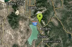
Bonneville Shoreline Trail - Cedar Hills to Grove Creek Canyon
Pleasant Grove, Utah
6.4 miles SEThe Cedar Hills to Grove Creek Canyon portion of the Bonneville Shoreline Trail is an intermediate level trail. There are some flat spots that are on old dirt roads, as well as single track...
Mountain Bike
Grove Creek Trail
Pleasant Grove, Utah
6.5 miles SEThe Grove Creek Trail falls from the upper shoulder of Mount Timpanogos down Grove Creek Canyon to Pleasant Grove. It's usually ridden as a shuttled downhill -- because the climb up this...
Hike, Mountain Bike 0.2 mi
Rocky Mouth Trail/Waterfalls
Sandy, Utah
6.6 miles NThis adventure begins with a very scenic hike to a beautiful waterfall and ends with a magnificent rappel through a short slot canyon and down the waterfall. The hike to the waterfall is a great trip...
Canyoneer, Hike, Rock Climb

Bear Canyon Loop
Provo, Utah
7.1 miles EA route for the thrill seeker, the Bear Canyon Loop is an advanced mountain biking route. This a challenging route and should be done only by those who know how to handle their bike on steep rocky...
Mountain Bike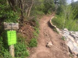
Tibble Fork
Provo, Utah
7.2 miles EThis trail is advanced tech and strenuous aerobic. This trail involves a few miles of riding on the pavement. Start by heading back down to the intersection with the South Fork of American Canyon and...
Mountain Bike
Tibble Fork Reservoir
Provo, Utah
7.2 miles EThere isn't one specific sledding run at this location. There's a great parking lot and hills above and below. It all depends on what kind of speed and excitement you're looking for....
Sled
G Mountain Trail
Pleasant Grove, Utah
7.4 miles SEThe trail starts at Kiwanis Park which is south of the 'G' at the end of Battle Creek Road. The trail starts out a little steep for about .25 mile and the very last bit is a...
Hike 1.2 mi
Battle Creek Falls
Pleasant Grove, Utah
7.5 miles SEBattle Creek Falls, located near Pleasant Grove, Utah, is a scenic waterfall that also has a rappelling and rock climbing area nearby. Hikers are allowed to see the falls from two view points, below...
Canyoneer, Hike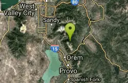
Timpanooke
Provo, Utah
7.5 miles EThis is a great trail. Intermediate tech and moderate aerobic. It winds through pine forests and grass meadows. Start by heading down the Timpanooke section of the Great Western Trail...
Mountain Bike 1.6-14.1 mi
Mount Timpanogas
Provo, Utah
7.5 miles EMt. Timp, as the locals call it, is the 2nd highest mountain in the Wasatch range (only Mt. Nebo is higher). What sets "Timp" apart is its location. It towers over the Provo, Orem, Pleasant...
Camp, Hike, Horseback, Swim 1.1-4.7 mi
Bells Canyon
Sandy, Utah
7.8 miles NBells Canyon is a moderate, 4.5 mile hike that begins in a residential area and ends at a waterfall in the enter of the canyon's forest. The first 1/2 mile of the hike is relatively...
Backpack, Hike, Mountain Bike, Snowshoe
White Pine Lake
Sandy, Utah
8.0 miles NEWhite Pine Canyon has long been the subject of intense controversy between advocates of wilderness and ski resort owners. The original boundaries of Lone Peak Wilderness Area, created in 1977, were...
Hike, Mountain Bike
Scruffy Band Little Cottonwood Canyon
Sandy, Utah
8.2 miles NRock Climb near Sandy, Utah
Rock Climb 3.2 mi
Little Cottonwood Pipeline Trail
Sandy, Utah
8.2 miles NLocated in Sandy, UT, Little Cottonwood Pipeline trail starts at the mouth of Little Cottonwood Canyon and is a single-track trail with some rocky situations on the trail. The first portion of the...
Mountain Bike 0.7 mi
Great White Icicle
Sandy, Utah
8.4 miles NThe Great White Icicle is located in Little Cottonwood Canyon just outside of Salt Lake City, Utah. It is a climbing area that is a frozen waterfall in the winter and a cascading waterfall...
Hike, Rock Climb
Lisa Falls
Sandy, Utah
8.7 miles NLisa Falls is a great place to climb Spring through Fall, any time of day. The base is well shaded by trees and offers many flat places to belay, or just hang out and relax. The roaring waterfall...
Hike, Rock Climb


