


Timpanooke
Provo, Utah
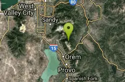
| Address: | ~Timpooneke Trailhead, Provo, UT 84604, USA |
| GPS: |
40°25'52.9"N 111°38'20.7"W Maps | Directions |
| State: | Utah |
| Trail Length: | 6.00 miles |
| MTB Difficulty: | Intermediate |
| Trail Type: | Loop |
| MTB Trail Type: | Singletrack |
Mountain Bike
This is a great trail. Intermediate tech and moderate aerobic. It winds through pine forests and grass meadows. Start by heading down the Timpanooke section of the Great Western Trail and turning left on a footbridge after .1 miles. Right heads up into the wilderness area where bikes are not allowed. Climb up through some cool pine forest hang left at the fork in the trail and cross the pavement. After about 1.5 miles from the start you will come to a 4 way section stay on the Great Western Trail by heading left. Continue straight when a trail comes in from the left and get ready to climb the steepest hill of the day. Cross a small creek and enjoy a beatiful meadow. Connect into the Ridge 157 trail and turn right about mile 3.0 and then fork right onto the Salmander flats trail while Ridge 157 goes left to the summit parking. Enjoy the downhill when you hit a 4 way trail intersection fork to the right and drop through the creek keeping to the right. You will come back to the 4-way intersection where you went left earlier in the trail this time stay straight and climb the short hill and enjoy retracing your steps back to the car in about 2.0 miles. Courtesy of Singletracks.com
Never modify trail features. Ride trails when they're dry enough that you won't leave ruts. Speak up when you see others on the trail and always yield to hikers, horses, and others coming uphill. Always ride on the established trail.
Read More- Plan Ahead and Prepare
- Travel & camp on durable surfaces
- Dispose of waste properly
- Leave what you find
- Minimize campfire impacts
- Respect wildlife
- Be considerate of other visitors
Directions
From Provo, Utah
- Head west on Center St toward N University Ave (1.5 mi)
- Take the ramp onto I-15 N (9.4 mi)
- Take exit 275 toward Pleasant Grove/American Fork (0.3 mi)
- Turn right onto Pleasant Grove Blvd (0.3 mi)
- Turn left onto N 2000 W St/N County BlvdContinue to follow N County Blvd(5.5 mi)
- Turn right onto W 11000 N (1.2 mi)
- Continue onto UT-92 E/Alpine Loop Scenic BywayMay be closed at certain times or days(8.4 mi)
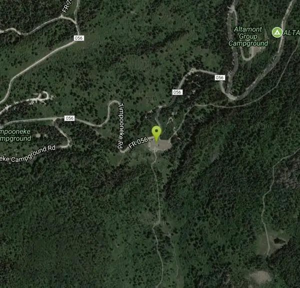
- Turn right onto FR 056/Timpooneke Rd (0.3 mi)
- Turn left onto Timpooneke Trailhead (72 ft)
Other Mountain Bike Trails Nearby
Ridge Trail #157
Provo, Utah
1.3 miles EThis trail is 15.7 miles in length and is commonly referred as the backbone of the American Fork Canyon trail system, because it connects several loop routes along the northern portion of the...
Mountain Bike
Bear Canyon Loop
Provo, Utah
1.3 miles NA route for the thrill seeker, the Bear Canyon Loop is an advanced mountain biking route. This a challenging route and should be done only by those who know how to handle their bike on steep rocky...
Mountain Bike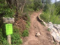
Tibble Fork
Provo, Utah
3.4 miles NThis trail is advanced tech and strenuous aerobic. This trail involves a few miles of riding on the pavement. Start by heading back down to the intersection with the South Fork of American Canyon and...
Mountain Bike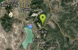
Archie's Loop
Sundance, Utah
4.2 miles SEArchie's Loop Trail, a 2.2 mile stretch of mountain biking/hiking trail, recently opened up totally new country. The intermediate-level trail runs from Scott's Pond loop to connect with...
Mountain Bike
Grove Creek Trail
Pleasant Grove, Utah
5.4 miles SWThe Grove Creek Trail falls from the upper shoulder of Mount Timpanogos down Grove Creek Canyon to Pleasant Grove. It's usually ridden as a shuttled downhill -- because the climb up this...
Hike, Mountain Bike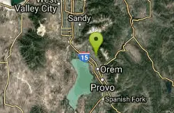
Bonneville Shoreline Trail - Cedar Hills to Grove Creek Canyon
Pleasant Grove, Utah
5.5 miles SWThe Cedar Hills to Grove Creek Canyon portion of the Bonneville Shoreline Trail is an intermediate level trail. There are some flat spots that are on old dirt roads, as well as single track...
Mountain Bike
Provo River Parkway Trail
Provo, Utah
6.3 miles SEThis isn't quite as much mountain biking as it is an easy downhill bike ride. The whole trail is paved. One of the best ways to do it is to take two vehicles and park one at Will's Canyon...
Hike, Mountain Bike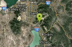
Rodeo Down
Alpine, Utah
6.3 miles WBlack Dog. Trail winds from the middle of Corkscrew down to Flank and River, just south of the water tank. Some technical aspects, length 0.5 miles with 300 vertical feet elevation...
Mountain Bike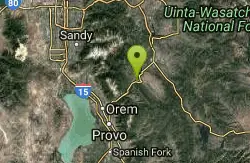
Deer Creek State Park
Wallsburg, Utah
7.1 miles EDeer Creek State Park is one of the finest year-round fishing spots in all of Utah. There are many different kinds of fish here and it is sure to not disappoint fisherman. Other...
Mountain Bike 1.7 mi
Schoolhouse Springs Trail
Alpine, Utah
7.3 miles NWSchoolhouse Springs trail has an elevation trail at 5,300 ft. It's located at the end of the town of Alpine. It features a lake and there's a number of activities including horse-back...
Hike, Mountain Bike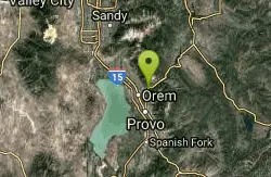
South Fork of the Provo
Provo, Utah
7.5 miles SSouth Fork of the Provo is a fun, short, scenic singletrack ride. It is an ideal trail to introduce a new mountain biker to the joys of singletrack! The trail has one or two rocky...
Mountain Bike
White Pine Lake
Sandy, Utah
7.9 miles NWhite Pine Canyon has long been the subject of intense controversy between advocates of wilderness and ski resort owners. The original boundaries of Lone Peak Wilderness Area, created in 1977, were...
Hike, Mountain Bike
Big Springs
Provo, Utah
9.1 miles SESingle track, winding through trees and an open meadow. Cross the service road about half way up to continue to the small water run off of Big Springs. There is approximately 1000 feet...
Mountain Bike
Mercer Hollow Trail
Draper, Utah
10.2 miles WMercer Hollow Trail is primarily used to bomb down the southern flanks of the ridge the Corner Canyon Trails sit on. It's filled with berms, rock features, rollers, and sweet, sweet...
Hike, Mountain Bike 1.7 mi
Jacob's Ladder Trail
Sandy, Utah
10.3 miles NWJacobs Ladder trail has an elevation trail of 5,700 ft. and the most popular trailhead out of the five trails in Lone Peak. It's located near a large area on the right side of the road...
Hike, Mountain Bike 0.2-1.8 mi
Lone Peak
Draper, Utah
10.3 miles NWEstablished in 1978 and located southeast of Salt Lake, Lone Peak is one of the taller peaks in the Wasatch range along the Wasatch Front. It has 5 main trailheads: Jacobs Ladder via Corner Canyon...
Hike, Mountain Bike, Rock Climb 1.2 mi
Ghost Falls Trail
Sandy, Utah
10.3 miles NWGhost Falls is located in the corner canyon riding area of Draper, Utah and one of the first mountain bike routes in the canyon. It's a family-friendly hike, named for the...
Hike, Mountain Bike, Snowshoe 1.3 mi
Eagle Crest Trail
Draper, Utah
10.7 miles WEagle Crest trail is a beginner level trail mountain bike in Draper, Utah along the north side of Traverse Mountain. From the trail, riders can see the Salt Lake Valley, the Northern end of Utah...
Hike, Mountain Bike 0.2 mi
Orson Smith trail
Draper, Utah
11.5 miles NWOrson Smith Trail is located north of the Corner Canyon Gate. It leads up to the suspension bridge and has become a popular spot for hiking and bike routes since the suspension...
Hike, Mountain Bike 0.6 mi
Potato Hill Trail
Draper, Utah
11.7 miles WLocated in Draper, UT, Potato Hill Trail start at the trailhead on Transverse Mountain Road. and goes down to the (BST) or Bonneville Shoreline Trail west of Coyote Hollow. There are some trails that...
Hike, Mountain BikeNearby Campsites

Mount Timpanogas
Provo, Utah
0.0 miles NMt. Timp, as the locals call it, is the 2nd highest mountain in the Wasatch range (only Mt. Nebo is higher). What sets "Timp" apart is its location. It towers over the Provo, Orem, Pleasant...
Camp, Hike, Horseback, Swim
Y-Mountain Summit Trail
Provo, Utah
12.9 miles SY Mountain is located directly east of Brigham Young University (BYU) in Provo, Utah, United States. The Slide Canyon/Y Mountain Trail leads to a large block Y located 1.2 miles (1.9 km) from a...
Camp, Hike
Spruces Campground
Salt Lake City, Utah
14.5 miles NCamping isn't free. See USDA.gov for details. If you know the coordinates of the sledding hill here, please comment.
Camp, Sled
Mill Creek Canyon
Salt Lake City, Utah
19.0 miles NMill Creek is an out and back with over 1000 ft of elevation gain. The lower section of the ski trail gets a lot of foot traffic, but the upper section (above Elbow Fork) is generally very quiet....
Camp, Cross-country Ski, Snowshoe 4.7 mi
Fifth Water Hot Springs
Provo, Utah
28.3 miles SEAKA Diamond Fork Hot Springs A beautiful drive and a 2.5 mile hike along the river will end you at an amazing set of hot springs that's well worth the trip. There's a variety of...
Backpack, Camp, Hike, Hot Springs, Mountain Bike, Swim
Holbrook Trailhead
Bountiful, Utah
32.9 miles Nairsoft feaild woth bunkers
Airsoft, Backpack, Camp, Paintball, Snowshoe
Hell Hole Lake
Evanston, Utah
48.3 miles NEThe first 250 feet of this trail are on private property with access provided by Kayenta. The trail is actually the northern portion of Dry Wash. Sand and boulders litter the wash making hiking...
Camp, Hike, Horseback


