


Tibble Fork
Provo, Utah
| Address: | ~Tibble Fork Dam, Provo, UT 84604, USA |
| GPS: |
40°28'51.7"N 111°38'43.6"W Maps | Directions |
| State: | Utah |
| Trail Length: | 11.00 miles |
| MTB Difficulty: | Intermediate |
| Trail Type: | Loop |
| MTB Trail Type: | Singletrack |
Mountain Bike
This trail is advanced tech and strenuous aerobic. This trail involves a few miles of riding on the pavement. Start by heading back down to the intersection with the South Fork of American Canyon and turnig left and climb up the hill to the Pine Hollow trailhead parking(as an alternate you could start here but you really don't want to climb that hill at the end of this ride) look for the trail on the opposite side of the street from the parking lot. Start the brutal climb up the Pine Hollow trail this narrow, rocky and steep after about 2 miles turn left onto the Great Western Trail and follow this up to Ridge 157 trail. Head north on Ridge 157 by turning left and follow this for 2 miles being sure to take the right hand turn at the Mud Springs fork of the trail. Here you will climb up through aspens and then a short fun downhill to the Tibble fork trail. Turn left onto Tibble fork and get ready to drop about 2000' over the next 3 miles and back down to your vehicle. Courtesy of Singletracks.com
More Information
Tibble Fork Trail
Tibble Fork Trail is a singletrack mountain bike trail in Alpine, Utah. View maps, videos, photos, and reviews of Tibble Fork Trail bike trail in Alpine.
http://www.singletracks.com/bike-trails/tibble-fork/Never modify trail features. Ride trails when they're dry enough that you won't leave ruts. Speak up when you see others on the trail and always yield to hikers, horses, and others coming uphill. Always ride on the established trail.
Read More- Plan Ahead and Prepare
- Travel & camp on durable surfaces
- Dispose of waste properly
- Leave what you find
- Minimize campfire impacts
- Respect wildlife
- Be considerate of other visitors
Directions
From Provo, Utah
- Head west on E Center St toward N University Ave (46 ft)
- Turn right at the 1st cross street onto N University Ave (4.7 mi)
- Continue onto US-189 N/N University AveContinue to follow US-189 N(18.2 mi)
- Turn left onto UT-113/3600 WContinue to follow UT-113(3.9 mi)
- Turn left onto W Main St (0.2 mi)
- Turn right at the 2nd cross street onto N 200 W (0.2 mi)
- Turn left at the 2nd cross street onto W 200 N (0.8 mi)
- Continue onto State Rte 222/Homestead DrContinue to follow State Rte 222(1.0 mi)
- Continue onto Snake Creek Rd (5.7 mi)
- Continue onto Cummings Pkwy (3.8 mi)
- Continue straight onto Baker Fork Rd (4.6 mi)
- Continue onto American Fork Canyon Rd (5.2 mi)
- Turn left onto UT-144 S (0.4 mi)
- Turn left onto Tibble Fork Rd (492 ft)

Other Mountain Bike Trails Nearby

Bear Canyon Loop
Provo, Utah
2.1 miles SAn advanced 8.4-to-longer-mile mountain biking loop through forested Wasatch switchbacks with 1,700 ft of elevation gain, steep rocky sections, and dramatic views from the ridge.
Mountain Bike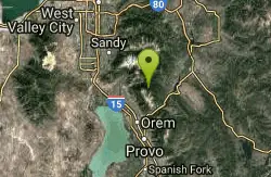
Timpanooke
Provo, Utah
3.4 miles SAn intermediate trail through pine forests and grass meadows on the Great Western Trail near Provo — creek crossings, a steep summit climb, and a fun downhill back to the trailhead.
Mountain Bike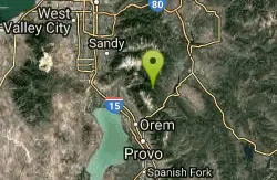
Ridge Trail #157
Provo, Utah
3.8 miles SEA 15.7-mile backbone trail in American Fork Canyon connecting multiple loop routes, with excellent views throughout and increasingly demanding terrain north of Mill Canyon — some of the best singletrack in the Wasatch.
Mountain Bike
White Pine Lake
Sandy, Utah
4.5 miles NWA canyon that ski resort lobbyists fought to keep out of wilderness, now open to hikers and rare mountain bikers — hike in and discover why everyone has been arguing over White Pine Canyon.
Hike, Mountain Bike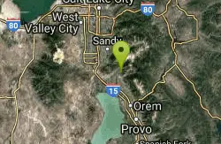
Rodeo Down
Alpine, Utah
5.9 miles WA dense network of named mountain bike trails in Alpine — Black Dog, Brown Dog, Corkscrew, Flank, and more — with varied technical character, rock stunts, and elevation changes up to 300 feet.
Mountain Bike 1.7 mi
Schoolhouse Springs Trail
Alpine, Utah
6.0 miles WA short, scenic trail at 5,300 feet in Alpine, Utah, featuring a lake and activities from horseback riding to hiking — best enjoyed between May and October.
Hike, Mountain Bike
Archie's Loop
Sundance, Utah
7.1 miles SEA 2.2-mile intermediate mountain bike and hiking trail near Sundance with panoramic views of Mt. Timpanogos, Provo Canyon, Deer Creek Reservoir, and the Heber Valley.
Mountain Bike
Grove Creek Trail
Pleasant Grove, Utah
8.0 miles SWA steep, shuttled downhill singletrack dropping from the shoulder of Mount Timpanogos through Grove Creek Canyon — the climb is brutal, but the descent is worth it.
Hike, Mountain Bike
Bonneville Shoreline Trail - Cedar Hills to Grove Creek Canyon
Pleasant Grove, Utah
8.1 miles SWA 3-mile intermediate mountain bike trail along the Bonneville Shoreline, connecting Cedar Hills to Grove Creek Canyon — mostly flat with some singletrack and a few intersecting routes near construction.
Mountain Bike
Deer Creek State Park
Wallsburg, Utah
8.7 miles SEOne of Utah's finest year-round fishing spots on Deer Creek's reservoir, plus boating, swimming, hiking, mountain biking, and camping near Wallsburg.
Mountain Bike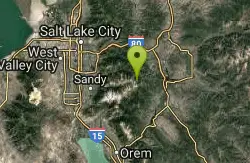
Brighton Lakes Loop
Salt Lake City, Utah
8.7 miles NA challenging mountain bike loop past four alpine lakes — Dog, Mary, Martha, and Catherine — in Big Cottonwood Canyon, with a wild descent down the Lake Mary trail.
Mountain Bike 1.7 mi
Jacob's Ladder Trail
Sandy, Utah
9.0 miles WJacob's Ladder is the steep, relentless local favorite for climbing into the Lone Peak Wilderness above Draper, Utah — and a legendary technical descent.
Hike, Mountain Bike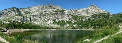
Silver Lake (Big Cottonwood)
Brighton, Utah
9.0 miles NA Wasatch Mountains trail passing three alpine lakes, abundant wildlife from chipmunks to moose, shady forest, and sweeping views — with the option to hike counter-clockwise for a gentler climb.
Hike, Mountain Bike 0.2-1.8 mi
Lone Peak
Draper, Utah
9.1 miles WOne of the Wasatch Front's taller peaks at over 11,000 feet, Lone Peak offers five different trailhead approaches, a 9-mile average round trip, rugged canyon terrain, and stunning Salt Lake valley views.
Hike, Mountain Bike, Rock Climb 1.2 mi
Ghost Falls Trail
Sandy, Utah
9.1 miles WA family-friendly hike in Corner Canyon that winds through sandy rocky slopes and dry creek beds to the Ghost Falls loop, with helpful trail signs at the confusing intersections.
Hike, Mountain Bike, Snowshoe 3.2 mi
Little Cottonwood Pipeline Trail
Sandy, Utah
9.2 miles NWA single-track trail starting at the mouth of Little Cottonwood Canyon that stays smooth for the first mile, then gets rocky and steep — ending across a creek from historic ruins after 3.5 miles.
Mountain Bike
Mercer Hollow Trail
Draper, Utah
9.4 miles WA fast, flowy descent on the southern flank of Corner Canyon Ridge, packed with berms, rock features, rollers, and a quick uphill that rewards you on the way back down.
Hike, Mountain Bike
Provo River Parkway Trail
Provo, Utah
9.5 miles SEA fully paved 6-mile canyon ride from Vivian Park to the mouth of Provo Canyon, passing waterfalls and a fish-feeding spot — best done with two cars for a car-shuttle downhill.
Hike, Mountain Bike 0.2 mi
Orson Smith trail
Draper, Utah
9.7 miles WA short Draper foothills trail leading to a popular suspension bridge completed in 2015 at Bear Canyon — connecting to the Bonneville Shoreline Trail and open to hikers, bikers, and bird watchers.
Hike, Mountain Bike 0.4 mi
Hidden Valley Park trail
Sandy, Utah
9.7 miles NWA hidden shallow valley of grass, sandstone cliffs, and Navajo Sandstone domes just south of Moab — loop options total about one mile, but bring water because it gets hot.
Hike, Mountain BikeNearby Campsites

Mount Timpanogas
Provo, Utah
3.4 miles SUtah's most-climbed mountain towers 7,000 feet above the Provo valley, stretching seven miles north to south with multiple peaks over 11,000 feet — a Wasatch landmark.
Camp, Hike, Horseback, Swim
Spruces Campground
Salt Lake City, Utah
11.1 miles NA fee campground in Big Cottonwood Canyon near Salt Lake City — check USDA.gov for current rates and seasonal availability.
Camp, Sled
Mill Creek Canyon
Salt Lake City, Utah
15.5 miles NAn out-and-back canyon trail with over 1,000 feet of elevation gain — the lower ski trail sees heavy traffic while the upper section above Elbow Fork stays quiet, with a reservable Yurt at the top December through April.
Camp, Cross-country Ski, Snowshoe
Y-Mountain Summit Trail
Provo, Utah
16.4 miles SA 1.2-mile climb east of BYU leads to a massive block Y on the hillside and sweeping panoramas over Provo, Orem, Utah Valley, and Utah Lake below.
Camp, Hike
Holbrook Trailhead
Bountiful, Utah
29.6 miles NThe Holbrook Trailhead is a popular access point for the Bonneville Shoreline Trail and Holbrook Canyon above Bountiful, Utah, on the western face of the Wasatch. Perched on the bench right at the...
Airsoft, Backpack, Camp, Paintball, Snowshoe 4.7 mi
Fifth Water Hot Springs
Provo, Utah
31.4 miles SEA scenic 2.5-mile riverside hike to the famous Diamond Fork rock pools and waterfall, with soaks up to 108°.
Backpack, Camp, Hike, Hot Springs, Mountain Bike, Swim
Hell Hole Lake
Evanston, Utah
46.9 miles NEA challenging wash hike in Evanston's Dry Wash, navigating sand and boulders for 1.8 miles to Hellhole Canyon at the edge of the Red Mountain Wilderness.
Camp, Hike, Horseback 5.6 mi
Antelope Island Lakeside Trail
Syracuse, Utah
48.7 miles NWAn easy 2-hour loop on Antelope Island around the Great Salt Lake, with rock formations, views of the Sierra Nevadas, and the GSL — kid-friendly and good for bug fans.
Camp, Hike, Horseback
Antelope Island State Park
Syracuse, Utah
48.9 miles NWTwenty miles of trails cross Utah's Great Salt Lake island alongside free-roaming bison, antelope, and bobcats — best visited in early spring or late fall to beat the bugs.
Backpack, Camp, Hike, Horseback, Mountain Bike


