


Blue Hole Park
Georgetown
Hike and Swim
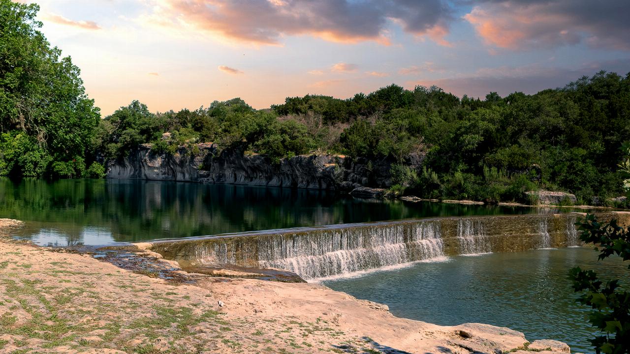
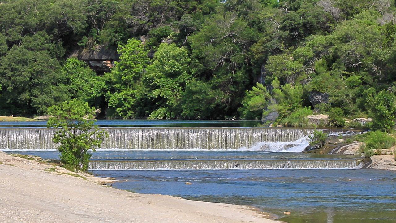
Blue Hole Park is a three acre city park in downtown Georgetown where the South Fork of the San Gabriel River widens into a long green pool under a wall of limestone bluff. A historic low dam crosses the river at the downstream end and spills over in a stepped waterfall, and that dam is what holds the water back and gives the hole its depth. The color is the draw. Limestone filters the flow until it reads green to turquoise against pale rock ledges, and the bluff on the north bank shades the deep end through much of the afternoon. Sycamores lean out over the banks and cedar crowds the rim above.
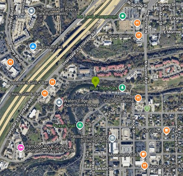
The entrance is at Second and Rock Streets, one block west of North Austin Avenue and about five blocks north of the Williamson County courthouse square. It is free. No gate, no reservation, no admission charge of any kind, which sets it apart from the ticketed Blue Hole Regional Park down in Wimberley that shares the name. Open 5 a.m. to 10 p.m. daily. Free public parking sits at Third and Rock Streets in a surface lot and a garage, and both fill fast on hot weekends. Restrooms and picnic areas are on site, and anglers work the tailwater below the spill for bass, catfish and sunfish.
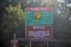
There are no lifeguards. The city says plainly that you enter the river at your own risk and that it does not monitor water flow or bacteria levels. Take that seriously. Swimmers along the San Gabriel have picked up bacterial skin and eye infections, and Georgetown has posted warning signs at the park about it. Runoff carries bacteria straight into the pool, so the days right after rain are the worst days to get in.
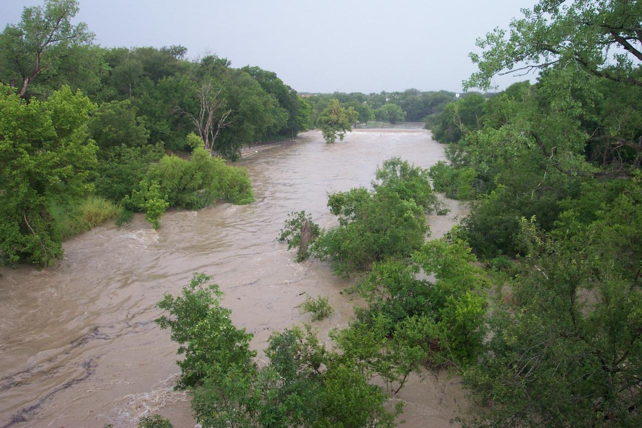
The river itself is the bigger hazard. This reach floods hard and fast. A November 2001 flood nearly wiped the park out, another came through in July 2002, and the Independence Day flooding of 2025 buried the park and its trails in gravel and debris. Blue Hole and its connecting trails closed on October 27, 2025 while crews hauled the deposits off the bank. If rain is falling upstream, stay out of the water.
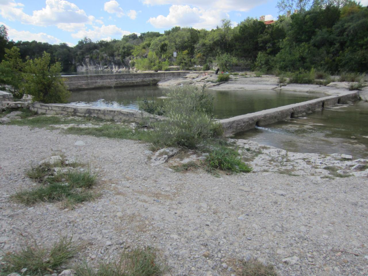
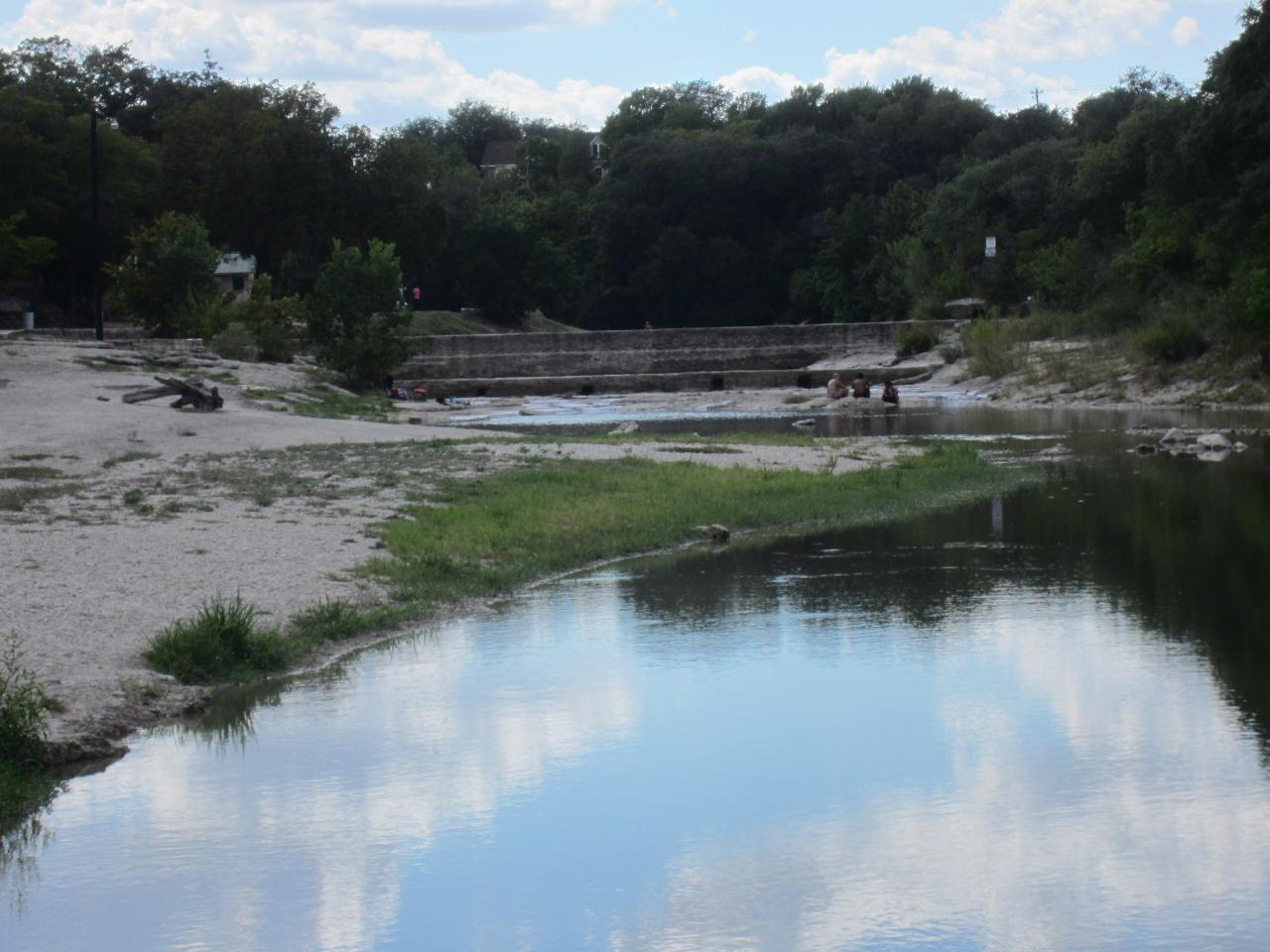
Depth swings with the weather. After a wet spring the pool is deep and swimmable bank to bank. In a dry August it drops to shallow ledges and gravel bars you can walk across. Diving or jumping from the cliffs and rock faces is prohibited by city ordinance, as are glass and alcohol, and dogs must be leashed.
Trails run out of the park both ways. The rustic half mile Pickett Trail climbs to Chautauqua Park, and the San Gabriel River trail system links Blue Hole to Rivery Park, San Gabriel Park and roughly eight connected miles of surface reaching Lake Georgetown. A $10.15 million city master plan goes to design in 2026 with construction expected in early 2027, adding parking, rebuilt restrooms, a paddle launch and riverbank stabilization.
More Information
Be courteous, informed, and prepared. Read trailhead guidelines, stay on the trail, and don't feed the wildlife.
Read More
- Plan Ahead and Prepare
- Travel & camp on durable surfaces
- Dispose of waste properly
- Leave what you find
- Minimize campfire impacts
- Respect wildlife
- Be considerate of other visitors
Directions
From Georgetown
- Head west on Volta Pl NW toward Cashell Alley (0.1 mi)
- Turn left onto 34th St NW (0.3 mi)
- Turn right onto M St NW (226 ft)
- Turn left onto Francis Scott Key Brg/
Key Bridge Entering Virginia(0.3 mi) - Continue onto N Ft Myer Dr (0.1 mi)
- Turn right onto Langston Blvd. (0.5 mi)
- Take the ramp on the left onto I-66 WToll road(73.1 mi)
- Take exit 1A to merge onto I-81 S toward Roanoke (228 mi)
- Keep left to continue on I-81 S/
US-52 N, follow signs for Bristol Continue to follow I-81 SEntering Tennessee(148 mi) - Take exit 1B for I-40 W toward Knoxville (0.7 mi)
- Merge onto I-40 (3.0 mi)
- Keep left to stay on I-40 (49.7 mi)
- Slight right to stay on I-40 (signs for Nashville) (155 mi)
- Continue straight to stay on I-40 (2.1 mi)
- Slight left to stay on I-40 (3.4 mi)
- Take the I-40 W exit on the left toward Memphis (0.4 mi)
- Continue onto I-40 W (1.4 mi)
- Keep right to stay on I-40 W, follow signs for Memphis (188 mi)
- Keep left to stay on I-40 W (1.5 mi)
- Keep left to stay on I-40 W (5.7 mi)
- Take exit 10A-10B for I-40 W toward Little Rock (0.8 mi)
- Continue onto I-40 W (7.9 mi)
- Keep left to stay on I-40 W (2.5 mi)
- Keep left to stay on I-40 W, follow signs for Little RockEntering Arkansas(10.5 mi)
- Keep left to stay on I-40 W, follow signs for Little Rock (123 mi)
- Take exit 153B on the left for I-30 W/
US-65 S/ US-67 S/ US-167 S toward Little Rock (0.6 mi) - Continue onto I-30 W/
US-167 S/ US-65 S/ US-67 S (4.3 mi) - Slight right onto I-30 W (signs for Texarkana)Entering Texas(284 mi)
- Continue onto I-30 W (20.6 mi)
- Take the exit onto I-635 S (9.2 mi)
- Merge onto I-20 W (11.9 mi)
- Take exit 467B to merge onto I-35E S toward Waco (48.2 mi)
- Keep left to stay on I-35E S (0.2 mi)
- Merge onto I-35 S (34.3 mi)
- Keep left to stay on I-35 S (43.3 mi)
- Keep left to stay on I-35 S, follow signs for Austin (26.5 mi)
- Keep left to stay on I-35 S, follow signs for Austin (3.7 mi)
- Take exit 261 toward TX-29/
Burnet (0.7 mi) - Merge onto S IH 35 Service Rd SPass by Wendy's (on the right in 0.3 mi)(1.1 mi)
- Sharp left onto Interstate 35 Frontage Rd N (signs for I-35 N/
Taylor) (0.9 mi) - Turn right onto San Gabriel Village BlvdDestination will be on the right(0.2 mi)
 The Blue Hole pool and its low stepped dam at sunset, with the limestone bluff line behind. courtesy of G. Lamar↗ (CC BY 2.0↗)
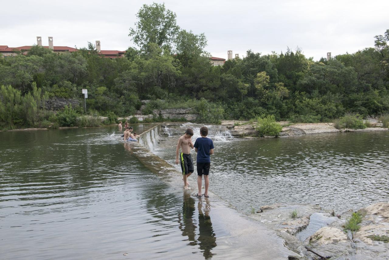
 Swimmers and waders on the low dam at Blue Hole Park on the South San Gabriel River. courtesy of Carol M. Highsmith↗ (Public domain↗)
 The double weir at Blue Hole spilling over clear green water below the cedar covered bluff. courtesy of Larry D. Moore↗ (CC BY 4.0↗)
 Limestone ledges and the dam apron at Blue Hole during a low water stretch in late summer. courtesy of Another Believer↗ (CC BY-SA 4.0↗)
 Waders in the shallows at the dam, with the park's gravel bank in the foreground. courtesy of Another Believer↗ (CC BY-SA 4.0↗)
 The South San Gabriel River in flood at Blue Hole Park, July 2002. courtesy of Ahodges7↗ (CC BY-SA 3.0↗)
Other Swimming Holes and Hiking Trails Nearby
Hippie Hollow Park
Austin, Texas
19.9 miles SWA clothing-optional park on 109 peaceful acres nestled in the natural Hill Country beauty of Lake Travis, just 20 minutes from Austin — a quiet nudist retreat away from city bustle.
Swim 0.3 mi
Mayfield Nature Preserve
Austin, Texas
23.4 miles SA 21-22 acre nature preserve in Austin with walking trails, a historic cottage, colorful cottage gardens, large palms, resident peacocks, and water lily ponds — no pets, open weekdays only.
Hike 0.4-0.9 mi
Wild Basin Wilderness Preserve
Austin, Texas
24.5 miles SA peaceful nature preserve with guided and self-guided hiking loops in Austin, including a stroller-friendly easy access path and plenty of wildlife and scenery.
Hike
Zilker Park
Austin, Texas
26.6 miles SZilker Metropolitan Park is the green heart of Austin, Texas, a sprawling 358-acre expanse along the Colorado River and Barton Creek that holds one of the city's true crown jewels: Barton Springs...
Hike, Swim
Barton Springs Pool
Austin, Texas
26.7 miles SA legendary 3-acre spring-fed pool in Zilker Park at a constant 70°F — Austin's beloved year-round swimming destination with deep roots in Texas history, adjacent to the greenbelt.
Swim
Hill Of Life
Austin, Texas
26.9 miles SThe Hill of Life is the steepest, most notorious stretch of Austin's Barton Creek Greenbelt, a rugged climb (or descent) at the western end of the Greenbelt near the Scottish Woods trailhead that...
Hike, Swim
Campbell's Hole, Austin, TX, USA
Austin, Texas
27.2 miles SCampbell's Hole is one of Austin's best-loved swimming holes, a deep, cold, spring-fed pool on Barton Creek in the heart of the Barton Creek Greenbelt. Sitting about half a mile up the creek from the...
Hike, Swim
Sculpture Falls
Austin, Texas
27.7 miles SSculpture Falls is a beloved Barton Creek Greenbelt swimming hole in Austin, where the creek carves clear pools into sculpted limestone ledges.
Hike, Swim
Twin Falls
Austin, Texas
28.5 miles STwin Falls is one of the best waterfall-and-swimming-hole hikes in Texas, a scenic stretch of Austin's beloved Barton Creek Greenbelt where the creek pours over limestone ledges into clear, cool...
Hike, Swim 1.2 mi
Barton Creek Greenbelt
Austin, Texas
28.5 miles SUp to 7.9 miles of biking, hiking, and trail running along Austin's Barton Creek, with multiple swimming access points including the famous Campbell's Hole and the beautiful Sculpture Falls.
Hike
Krause Springs
Spicewood, Texas
30.2 miles WCamp and Swim near Spicewood, Texas
Camp, Swim
Upper McKinney Falls Swimming Hole
Austin, Texas
31.8 miles SSwimming below the Upper Falls of Onion Creek at McKinney Falls State Park, a limestone swimming hole 13 miles from the Texas Capitol in southeast Austin.
Camp, Hike, Mountain Bike, Swim
Pedernales Falls
Johnson City, Texas
40.2 miles SWLimestone waterfalls and downstream pools of varying depth make Pedernales Falls a classic Texas swimming hole — wade, swim, hike, and camp all in one state park visit.
Camp, Hike, Horseback, Mountain Bike, Swim
Pedernales Area
Perryton, Texas
40.2 miles SWSwim near Perryton, Texas
Swim
Hancock Springs Pool
Lampasas, Texas
41.1 miles NWA historic sulfurous spring, once a health resort, now a spring-fed town pool — a uniquely retro swim spot in Lampasas, Texas. Fee required.
Swim 0.1 mi
Devils Water Hole
Burnet, Texas
41.5 miles WA canyon swimming hole tucked inside Inks Lake State Park, surrounded by beautiful rock formations with diving spots and calm, deep water — reserve ahead, as the nearest parking fills fast.
Hike, Swim
Bastrop State Park
Bastrop, Texas
43.8 miles SEBastrop State Park packs in backpacking, camping, canoeing, swimming, golf, and a 12-mile scenic bike ride through the Lost Pines of east Central Texas.
Camp, Hike, Mountain Bike
Llano Slab
Kingsland, Texas
47.7 miles WGranite formations divide the Llano River into calm pools of varying depth, creating a natural playground of sandy beaches and clear water for wading and swimming.
SwimNearby Campsites
Krause Springs
Spicewood, Texas
30.2 miles WCamp and Swim near Spicewood, Texas
Camp, Swim
Upper McKinney Falls Swimming Hole
Austin, Texas
31.8 miles SSwimming below the Upper Falls of Onion Creek at McKinney Falls State Park, a limestone swimming hole 13 miles from the Texas Capitol in southeast Austin.
Camp, Hike, Mountain Bike, Swim
Pedernales Falls
Johnson City, Texas
40.2 miles SWLimestone waterfalls and downstream pools of varying depth make Pedernales Falls a classic Texas swimming hole — wade, swim, hike, and camp all in one state park visit.
Camp, Hike, Horseback, Mountain Bike, Swim
Bastrop State Park
Bastrop, Texas
43.8 miles SEBastrop State Park packs in backpacking, camping, canoeing, swimming, golf, and a 12-mile scenic bike ride through the Lost Pines of east Central Texas.
Camp, Hike, Mountain Bike


