


Gold Lake
Graeagle

Camp, Canoe, Hike, Kayak, and Swim
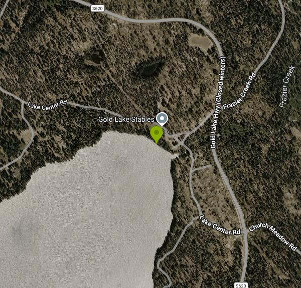
Gold Lake is the largest lake in the Lakes Basin Recreation Area, a cluster of glacier-carved lakes in the northern Sierra Nevada managed by the Plumas National Forest's Beckwourth Ranger District. The lake sits at about 6,400 feet in Sierra County, covers roughly 510 acres, and drains out its north end into Frazier Creek, which drops over Frazier Falls on its way to the Middle Fork of the Feather River. "Lakes Basin" is the name of the whole recreation area, which holds more than 20 lakes. Gold Lake is the big drive-up lake in it, and this listing points at the free day-use area beside the dam on its north shore.
From Graeagle, drive about 1.5 miles southeast on Highway 89 and turn south onto Gold Lake Highway, then follow it roughly 7 miles to the lake. From Sierra City, take Highway 49 east to Bassetts and follow Gold Lake Highway north over the summit. The main boat launch has a large paved lot. The Forest Service warns that the road running north from the boat launch toward the campground is narrow and rough, so take it slowly if you are heading for the dam end. Most of the area and the highway are snowbound in winter.
Swimming is a listed activity at Gold Lake, with one firm rule: no swimming or fishing near the boating facilities, meaning the two-lane concrete ramp and its loading dock. Swim instead at the Gold Lake Dam Day Use Area (the Forest Service calls it the cartop launch and day use area), which has a gravel hand-launch ramp for kayaks, canoes and paddleboards, vault toilets, and no drinking water. Don't expect a groomed beach. The Forest Service doesn't list a marked swim zone or lifeguards anywhere on the lake. At this elevation the water stays cold even in midsummer, and July and August are the realistic swimming months.
The dam day-use area is free and open 24 hours a day. The main boat launch charges a $10 daily launch and day-use fee, and campground hosts sell an $85 annual pass. The Forest Service ends fees, services and the boat dock at the launch in mid-October, when the 37-site Gold Lake Campground closes for the season. Bring your own water, since there is no potable water at the lake.
Gold Lake is open to every kind of boat. Water-skiers, jet skis, sailboats and windsurfers all share the lake with swimmers on summer weekends, so stay close to shore and carry a bright float if you swim out where boats run. Keep away from the dam outlet, and use care along Frazier Creek downstream, where the current runs fast above the falls.
The lake makes a good base for the rest of the basin. More than 30 miles of trails connect dozens of smaller lakes and reach the Pacific Crest Trail. The short paved Frazier Falls trail starts off Frazier Falls Road, back toward Graeagle, and Goose Lake, next door, bans motorboats if you want calmer water. Besides Gold Lake Campground, campers can use Lakes Basin Campground on Gray Eagle Creek or the primitive Gold Lake 4x4 Campground on the far shore, which is reached only by a boulder-strewn off-highway road and has no water or toilets.
More Information
Gold Lake 4 X 4 Campground, Plumas National Forest - Recreation.gov
Explore Gold Lake 4 X 4 Campground in Plumas National Forest, California with Recreation.gov. Gold Lake 4x4 campground in northeast Plumas County, CA lies at 6,400 feet in elevation within the Plumas National Forest. The mountains, forest and lake sett
https://www.recreation.gov/camping/campgrounds/10309566Gold Lake Kayaing | Best Places for Kayaking and Paddleboarding in California
Explore flat water kayak, and stand-up paddleboarding at Gold Lake, in California. Downloadable paddlers guide for California lakes, reservoirs, rivers, harbors and bays.
https://www.paddlingcalifornia.com/Gold_Lake.htmlLakes Basin Recreational Area
Elevate Your Adventure: Explore the Best Hiking Trails in the Lakes Basin Recreation Area with Sierra Rec Magazine. Discover pristine alpine lakes, breathtaking vistas, and a wealth of outdoor experiences. Become a Lakes Basin expert with our comprehensive trail guide!
https://sierrarecmagazine.com/explore-lassen-plumas/lakes-basin-recreational-area/Lakes Basin, Plumas National Forest - Recreation.gov
Explore Lakes Basin in Plumas National Forest, California with Recreation.gov. Lakes Basin Campground (6,445 feet) is situated in the ruins of an old lodge, Lakes Center Lodge, built in 1912 and removed in the late 1970's. Some of the old
https://www.recreation.gov/camping/campgrounds/231963Plumas National Forest | Gold Lake Campground | Forest Service
Gold Lake Campground is located along the shores of Gold Lake at an elevation of 6,400 feet. There are 37 campsites available. The road leading north of the boat launch facility is narrow and rough and may not be suited to your vehicle. Vault toilets are available and from May to October portable toilets are installed. Trash collection is available from May to October. No water is available.
https://www.fs.usda.gov/r05/plumas/recreation/gold-lake-campgroundPlumas National Forest | Gold Lake in Lakes Basin | Forest Service
Gold Lake is the largest lake in the Lakes Basin Recreation Area. Its clear blue water spills into Frazier Creek and down to the Middle Fork of the Feather River. Native Americans came into the area for hunting and gathering and left no traces of permanent settlement. Gold Lake got its name from a story in the early days of the gold rush by Thomas Robertson Stoddard. His story included finding a lake with shores lined with gold before being driven away by hostiles. Today the lake and surrounding area is known for its abundant recreation opportunities. The lake has two boat launch areas, two campgrounds, equestrian trail rides.Nearby are dozens of glacially carved alpine lakes and connecting trails. There are additional campgrounds, rustic lodges, world class mountain biking, 4X4 roads, waterfalls and fire lookouts.
https://www.fs.usda.gov/r05/plumas/recreation/gold-lake-lakes-basinPlumas National Forest | Lakes Basin Recreation Area | Forest Service
Located nine miles southwest of Graeagle, California, this recreation area has special geological features. There is breathtaking scenery and over 20 small lakes nearby, most of which are accessible by hiking trails. This area provides a multitude of recreational activities including camping, fishing, boating, hunting, mountain biking, horseback riding, picnicking, hiking, backpacking, swimming, windsurfing and nature study. In the winter visitors can snowmobile, cross-country ski and snowshoe.
https://www.fs.usda.gov/r05/plumas/recreation/lakes-basin-recreation-areaPlumas National Forest | Project Summary (#38023) | Forest Service
Improve recreation facilities, providing 63 boat parking stalls and three accessible parking stalls for visitors.This project is in partnership withthe Department of Boating and Waterways.
https://www.fs.usda.gov/r05/plumas/projects/38023The Lakes Basin In California's 'Secret Sierra' Offers Lakefront Camping, Scenic Hiking, And Outdoor
The area of the Sierras is a paradise for hikers and campers looking to bypass the Tahoe crowds, with quiet lakeside campsites and miles to explore.
https://www.islands.com/2111478/stunning-lakes-basin-california-secret-sierra-endless-campsites-hiking-adventure/Be courteous, informed, and prepared. Read trailhead guidelines, stay on the trail, and don't feed the wildlife.
Read More
- Plan Ahead and Prepare
- Travel & camp on durable surfaces
- Dispose of waste properly
- Leave what you find
- Minimize campfire impacts
- Respect wildlife
- Be considerate of other visitors
Directions
From Graeagle
- Head southwest toward CA-89 N (46 ft)
- Turn left onto CA-89 S (1.4 mi)
- Turn right onto Gold Lake Hwy (1.7 mi)
- Turn left onto Frazier Creek Rd (5.7 mi)
- Continue straight (427 ft)
- Turn right toward Lake Center Rd (226 ft)
- Slight right onto Lake Center RdRestricted usage roadDestination will be on the left(62 ft)


Other Swimming Holes, Hiking Trails, Canoeing Areas, and Kayaking Areas Nearby

Palisades Creek Trail
Truckee, California
28.9 miles SA difficult Sierra Nevada trail past Palisade Falls — one of the tallest on the American River — with views of Devils Peak, alpine lakes, and 2,000 feet of elevation gain.
Hike, Swim
Heath Falls Overlook Trail
Truckee, California
28.9 miles SHike and Swim near Truckee, California
Hike, Swim
North Fork Falls
Colfax, California
29.5 miles SClear water, cliff-jumping pools, and waterfalls at Sierra Nevada's North Fork Falls — a summer hike to two deep pools with 10-to-25-foot cliffs ready for leaping.
Camp, Hike, Swim 0.1 mi
Edwards Crossing
Nevada City, California
30.6 miles SWDeep blue water, rock cliffs, and a sandy beach on the Yuba River — with a half-mile walk from the parking lot and cliff jumping spots up to 20 feet deep.
Hike, Swim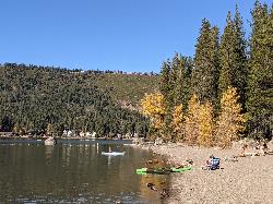
China Cove Beach
Truckee
32.9 miles SEChina Cove Beach is the sandy, shallow corner at the west end of Donner Memorial State Park, on the south shore of Donner Lake outside Truckee. California State Parks runs it, access is open to anyone paying the 10 dollar day use parking fee, and there is
Camp, Canoe, Hike, Kayak, Swim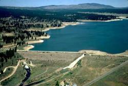
Boca Reservoir Hidden Beach
Truckee, California
35.0 miles SESandy informal beaches on the northeast shore of Boca Reservoir above Truckee, free to use, windy in the afternoons, and drawn down hard by the end of summer.
Camp, Canoe, Kayak, Kiteboard, Swim
Hoyt's Crossing
Nevada City
35.3 miles SWA deep pool and boulder beach on the South Yuba River in South Yuba River State Park, reached by a 0.75-mile walk on the Hoyt Trail from the Highway 49 bridges north of Nevada City. Free to walk in.
Hike, Swim
Jones Bar
Nevada City
36.7 miles SWA primitive South Yuba River swimming hole at the mouth of Rush Creek in South Yuba River State Park, reached by a steep trail from the Independence Trail lot on Highway 49 or a rough 4WD road. No fee posted at the bar.
Hike, Swim
Tahoe Area
Olympic Valley, California
39.0 miles SESwim near Olympic Valley, California
Swim
Shirley Canyon
Olympic Valley, California
39.5 miles SEShirley Canyon is widely regarded as one of Lake Tahoe's finest half-day hikes, a spectacular climb up a granite canyon that rises straight out of the base of the Palisades Tahoe ski resort in...
Hike 4.1 mi
Shirley Lake Canyon Trail
Olympic Valley, California
40.1 miles SEA 2.5-mile hike from Squaw Valley Village past streams and waterfalls to a pure Sierra lake — rocky near the top, with a free gondola ride back down from High Camp as a reward.
Hike, Swim
Commons Beach
Tahoe City
44.8 miles SEFree public beach and lakefront park in downtown Tahoe City on Lake Tahoe, run by the Tahoe City PUD, with cold clear water, a sand and cobble shore, kayak rentals and free summer concerts.
Kayak, Swim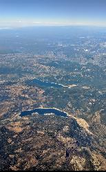
Hell Hole Reservoir
Georgetown
45.0 miles SA 4,630 foot Rubicon River reservoir in the Eldorado National Forest, 51 miles and two hours east of Georgetown, where the boat ramp cove is the only drivable shoreline and the lake drops over 100 feet by September.
Camp, Canoe, Hike, Kayak, Swim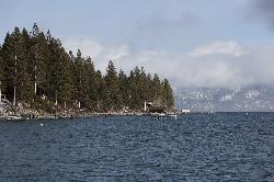
Lake Forest Beach
Tahoe City
45.1 miles SEA free public beach at the end of Bristlecone Street, owned by Placer County and run by the Tahoe City Public Utility District. Sandy, pine shaded and genuinely quiet, with the one real constraint being how few cars fit at the end of the road.
Camp, Canoe, Kayak, Swim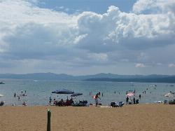
Kings Beach State Recreation Area
Kings Beach
45.5 miles SEA wide sand beach with a shallow, gently sloping entry on Lake Tahoe's north shore, run by California State Parks in downtown Kings Beach. Parking costs $3 an hour or $10 a day, charged year round.
Kayak, Swim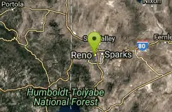
Reno Area
McGill, Nevada
45.5 miles ESwim near McGill, Nevada
Swim
Wingfield Park
Reno, Nevada
45.6 miles EAn oasis in downtown Reno where manmade dams and natural rock formations turn the Truckee River into a playground for swimming, kayaking, tubing, and rafting.
Kayak, Swim
William Kent Beach
Tahoe City
46.1 miles SEA free Forest Service swim beach on Lake Tahoe's West Shore, two miles south of Tahoe City on Highway 89, with a pebbly shore, cold clear water and picnic tables across from William Kent Campground.
Kayak, SwimNearby Campsites
North Fork Falls
Colfax, California
29.5 miles SClear water, cliff-jumping pools, and waterfalls at Sierra Nevada's North Fork Falls — a summer hike to two deep pools with 10-to-25-foot cliffs ready for leaping.
Camp, Hike, Swim
China Cove Beach
Truckee
32.9 miles SEChina Cove Beach is the sandy, shallow corner at the west end of Donner Memorial State Park, on the south shore of Donner Lake outside Truckee. California State Parks runs it, access is open to anyone paying the 10 dollar day use parking fee, and there is
Camp, Canoe, Hike, Kayak, Swim
Boca Reservoir Hidden Beach
Truckee, California
35.0 miles SESandy informal beaches on the northeast shore of Boca Reservoir above Truckee, free to use, windy in the afternoons, and drawn down hard by the end of summer.
Camp, Canoe, Kayak, Kiteboard, Swim
Hell Hole Reservoir
Georgetown
45.0 miles SA 4,630 foot Rubicon River reservoir in the Eldorado National Forest, 51 miles and two hours east of Georgetown, where the boat ramp cove is the only drivable shoreline and the lake drops over 100 feet by September.
Camp, Canoe, Hike, Kayak, Swim
Lake Forest Beach
Tahoe City
45.1 miles SEA free public beach at the end of Bristlecone Street, owned by Placer County and run by the Tahoe City Public Utility District. Sandy, pine shaded and genuinely quiet, with the one real constraint being how few cars fit at the end of the road.
Camp, Canoe, Kayak, Swim


