


18 Hiking Trails near Nantahala, NC 28713
first prev 1 next lastShowing Hiking Trails within 50 miles Distance miles of Nantahala, NC 28713, USA City, Zip, or Address
Mt. LeConte Lodge
Sylva, North Carolina
23.9 miles EThe highest guest lodge in the eastern United States at 6,400 feet, with spectacular Smokies views from an open glade just below the Mt. LeConte summit in Great Smoky Mountains NP.
Camp, Hike, Horseback, Rock Climb 
Davis Branch
Tellico Plains, Tennessee
24.3 miles WA riverside campground on the Tellico River with six campsites, each with a picnic table — a peaceful Tennessee base camp for hiking, fishing, and campfire nights.
Camp, Hike, Swim 
Baby Falls
Tellico Plains, Tennessee
28.9 miles WA Tellico River waterfall and swimming hole that's beginner-friendly for kayakers, beautiful for hikers, and especially stunning in fall for picnics and photography.
Hike, Kayak, Swim, Whitewater 
War Woman Dell Wildlife Management Area
Clayton, Georgia
33.3 miles SEA short 0.8-mile out-and-back hike near Clayton, Georgia through a nature trail to a waterfall — good for all skill levels and accessible year-round.
Camp, Hike, Horseback 3.8 mi
Ramsey Cascades
Gatlinburg, Tennessee
33.5 miles NERamsey Cascades is the tallest waterfall in Great Smoky Mountains National Park — a thundering 100-foot, multi-tiered cascade hidden deep in the old-growth forest of the Greenbrier area near...
Hike, Kayak, Swim, Whitewater 
Tallulah Falls Lake Beach (Terrora Day Use Area)
Tallulah Falls, Georgia
40.9 miles SSand swim beach on 63-acre Tallulah Falls Lake at Tallulah Gorge State Park's Terrora Day Use Area, with the gorge rim trails, suspension bridge and campground next door.
Camp, Hike, Kayak, Mountain Bike, Swim 1.4 mi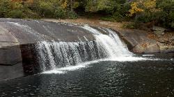
Turtleback Falls
Lake Toxaway, North Carolina
41.8 miles ETurtleback Falls' dome-shaped slide drops riders 10 feet into the Chug Hole pool, but wait for calm currents — strong flows have swept swimmers downriver over 125-foot Rainbow Falls.
Backpack, Hike, Swim 1.0 mi
Hidden Falls
Lake Toxaway, North Carolina
42.1 miles EJust a few steps off the Horsepasture River trail, Hidden Falls drops less than ten feet into an idyllic boulder-rimmed pool — a serene and easy family swimming hole.
Hike, Swim 1.3 mi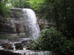
Rainbow Falls
Lake Toxaway, North Carolina
42.4 miles EA 150-foot spectacular cascade on the Horsepasture River can be admired from front, side, bottom, and top — one showstopper in a 2-mile series of incredible falls.
Hike, Swim 1.8 mi
Flat Laurel Creek
42.8 miles E
A 3.18-mile multi-use trail following Flat Laurel Creek through colorful rock formations and forest, with distant views of Sam Knob and a small waterfall — open year round.
Hike, Horseback, Mountain Bike, Swim 
Courthouse Falls
43.6 miles E
A gorgeous 45-foot waterfall streams into a stunning blue-green pool in a greenery-covered cliff cove — just a 3/4-mile easy hike from the parking lot, open year-round.
Hike, Swim 0.2-2.8 mi
Graveyard Fields
Brevard, North Carolina
46.3 miles ETwo cascading waterfalls — a swimmable Lower Falls just 1/3 mile from the road, and a more challenging Upper Falls on a 3.5-mile wildflower loop — make this a must-see hike.
Hike, Swim 
Skinny Dip Falls
Brevard, North Carolina
47.0 miles EA cascading waterfall with multiple clear pools for wading and swimming, a 6-foot jumping spot, and an easy 3/4-mile forested walk from the Blue Ridge Parkway — swimmers should mind fast water and slippery rocks.
Hike, Swim 7.1 mi
Daniel Ridge Loop
Canton, North Carolina
47.2 miles EA classic short Pisgah loop with moderate technical riding, a rocky downhill roller coaster, two waterfalls, and multiple route options to tailor the adventure.
Hike, Mountain Bike 3.1-4.3 mi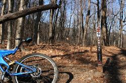
Farlow Gap
Canton, North Carolina
47.3 miles EOne of Pisgah's most technical downhills — a minefield of boulders dropping 2,000 feet in 3 miles, best ridden as part of the Fish Hatchery loop.
Hike, Mountain Bike 

Big East Fork
Canton, North Carolina
48.2 miles EHeavy forest, multiple waterfalls, and a river that shifts from white rapids to calm swimming holes along Big East Fork in Pisgah National Forest — great for kayaking, camping, and swimming year-round.
Backpack, Hike, Kayak, Swim 0.8 mi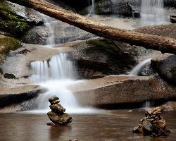
Daniel Ridge Falls
Brevard, North Carolina
49.3 miles EAn easy half-mile hike in Pisgah National Forest near Brevard to a 150-foot waterfall known by three names — most impressive after rain, modest in dry spells, with an optional 4-mile loop to the top.
Hike, Mountain Bike, Swim 
Butter Gap / Trail #123
Brevard, North Carolina
49.4 miles EButter Gap Trail in Pisgah Forest climbs about 1,000 feet and connects to FS 471D — the western fork is open to mountain bikes, with seasonal bike access on part of the route.
Hike, Mountain Bike


