


Map of 230 Things to do near Driggs, ID
first prev 1 2 3 4 5 6 7 8 9 10 next lastShowing results within 50 miles Distance miles of Driggs, ID, USA City, Zip, or Address

South Fork Snake River Trail
Ririe, Idaho
20.3 miles SWGo left at the trail head. It heads down about a mile and a half on double track. Then you'll come to a creek crossing. After the crossing the trail heads across a gate. Head left...
Mountain Bike
The Arcane
Ririe, Idaho
21.7 miles WRock Climb near Ririe, Idaho
Rock Climb

Wolverine Creek Trail
Ririe, Idaho
22.7 miles WThe Wolverine Creek Trail is a doubletrack trail in Ririe, Idaho. It begins at South Fork Road and ends at Wolverine trailhead. It is commonly used by dirt bikes and four wheelers. This trail is...
Mountain Bike 5.6-8.3 mi
Palisades Creek Trail / Lakes and Waterfall Canyon
Irwin, Idaho
23.0 miles SPalisades Creek Trail is located about 50 miles southeast of Idaho Falls and about 60 miles west of Jackson Hole WY in Swan Valley Idaho. The four mile hike up to lower Palisades Lake or the 6.2 mile...
Backpack, Camp, Hike, Horseback, Mountain Bike 0.6-2.2 mi
Fish Creek Area
Ririe, Idaho
23.1 miles WCLOSED. This land is owned and managed by the US Forest Service and is not designated for use. As of July 2024, being caught mountain biking on this trail could recieve up to a $5000 fine and a...
Hike, Mountain Bike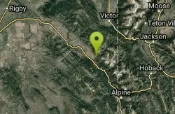
Hunts Corral
Irwin, Idaho
23.1 miles SNon-motorized use only. source: fs.usda.gov
Mountain Bike
Fall Creek Falls
Swan Valley, Idaho
23.6 miles SWFalls Campground is located next to the Snake River near beautiful Swan Valley, only 45 miles east of Idaho Falls, Idaho. Mixed growth cottonwood trees provide partial shade, and grassy meadows with...
Camp, Cave, Hike, Kayak, Swim
Falls Campground
Victor, Idaho
23.7 miles SWFalls Campground is located next to the Snake River near beautiful Swan Valley, only 45 miles east of Idaho Falls, Idaho. Mixed growth cottonwood trees provide partial shade, and grassy meadows...
Camp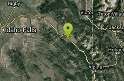
Flat Iron Trail
Swan Valley, Idaho
24.2 miles SWOHV trail. source: fs.usda.gov
Mountain Bike
Kelly Canyon Loops
Ririe, Idaho
24.4 miles WThis mountain bike trail near Kelly Canyon Ski Area has several options available. Highlights are the views in all directions from the top of the mountain. Trails: Waterfall...
Mountain Bike 4.3 mi
Leaning Fir #169
Ririe, Idaho
24.4 miles WMountain Bike near Ririe, Idaho
Mountain Bike 0.5-3.5 mi
Webster's Dam
Ririe, Idaho
24.4 miles WAlso known as Manmade Falls or the Woodmansee Dam, Webster Dam is an abandoned dam located deep in Moody Creek canyon, the dam was abandoned when sediment built up behind the dam which then...
Camp, Hike, Mountain Bike 11.9 mi
Waterfall Loop
Ririe, Idaho
24.5 miles WTrail is a mixture of single track, forest road and double track. Provides a variety of scenery. About 1400 feet of elevation change throughout the trail.GPS is a must unless you are going with...
Mountain Bike 0.8 mi
Conant Creek Pegram Truss Railroad Bridge
Ashton, Idaho
24.6 miles NWAs part of the Rails to Trails project, this old railroad bridge has been transformed into a very safe little viewing experience for the whole family. You can drive right up to the bridge where there...
Hike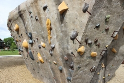
Phil Baux Park
Jackson, Wyoming
24.7 miles SEPhil Baux park has your typical park equipment such as a playground, swing set, small picnic shelter, 8 picnic tables, horseshoe pits and plenty of green grass for other recreational...
Rock Climb
Sheep Falls on Fall River
Ashton, Idaho
24.7 miles NThe lesser known Sheep Falls on Fall River is a local treasure off of Cave Falls road. There are primitive campsites and beautiful views for a great picnic spot. The water splits and comes down in...
Camp
Bighole Mountains / Moody
Ririe, Idaho
24.7 miles WThis is a little unofficial campground with a plenty of shade for your basecamp and a wooded field with great boundaries. There's 2 roads that split and merge giving you very simple...
Airsoft, Paintball
Falls River, Lower Run
Ashton, Idaho
24.7 miles NFall River rises on the Madison and Pitchstone plateaus in the southwest corner of Yellowstone National Park, Wyoming and flows approximately 64 miles (103 km) to its confluence with the Henrys Fork...
Whitewater
Lower Hawley Gulch Trail
Ririe, Idaho
24.7 miles WThis is a singletrack biking trail in Ririe, Idaho. The trail is mainly flat with a few gradual slopes. You may have to carry your bike over obstacles such as fallen trees, logs, and small ponds....
Mountain Bike
Table Rock Campground
Ririe, Idaho
24.8 miles WTable Rock / Poison Flat Campground is located at the Caribou-Targhee National Forest which occupies over 3 million acres and stretches across southeastern Idaho, from the Montana, Utah, and Wyoming...
Camp


