


23 Hiking Trails near Finnion Lake
first prev 1 2 next lastShowing Hiking Trails within 50 miles Distance miles of Finnion Lake near Placerville, California City, Zip, or Address
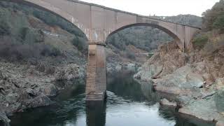
Quarry Trail
Cool, California
17.7 miles NWA riverside hike along an old limestone railway line to a dramatic amphitheater quarry — wildflowers peak April through June, and the historic railway story (scrap metal for WWII) adds a fascinating layer.
Hike
American River Confluence
Auburn, California
18.1 miles NWThe Confluence — where the North and Middle Forks of the American River meet below Foresthill Bridge — is Auburn's favorite swimming and rafting hub.
Hike, Horseback, Kayak, Rock Climb, Swim, Whitewater 1.2-2.7 mi
Lake Clementine Trail Loop
Auburn, California
18.1 miles NWFour connected trails loop around Lake Clementine on the North Fork American River — wheelchair accessible, pet friendly, and great for fishing, camping, and family summer outings.
Camp, Canoe, Hike, Kayak, Mountain Bike, Swim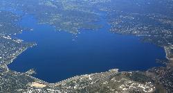
Granite Bay Main Beach
Granite Bay, California
18.8 miles WThe largest sand beach on Folsom Lake, guarded in summer, twenty five minutes from downtown Sacramento at the end of Douglas Boulevard.
Canoe, Hike, Kayak, Swim
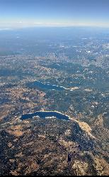
Hell Hole Reservoir
Georgetown
30.8 miles NEA 4,630 foot Rubicon River reservoir in the Eldorado National Forest, 51 miles and two hours east of Georgetown, where the boat ramp cove is the only drivable shoreline and the lake drops over 100 feet by September.
Camp, Canoe, Hike, Kayak, Swim
Paradise Beach
Sacramento
35.4 miles WA free sandy beach on an oxbow bend of the American River in Sacramento's River Park neighborhood, reached on foot over the levee from Glenn Hall Park and open sunrise to sunset.
Hike, Swim
North Fork Falls
Colfax, California
37.3 miles NClear water, cliff-jumping pools, and waterfalls at Sierra Nevada's North Fork Falls — a summer hike to two deep pools with 10-to-25-foot cliffs ready for leaping.
Camp, Hike, Swim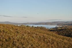
New Hogan Lake
Valley Springs, California
38.2 miles SNew Hogan Lake is a 4,400-acre reservoir tucked into the golden Sierra Nevada foothills of Calaveras County, California, about 30 miles northeast of Stockton near the little town of Valley Springs....
Backpack, Camp, Hike, Swim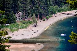
Vikingsholm Beach
South Lake Tahoe
40.3 miles ESandy beach at the head of Emerald Bay in Emerald Bay State Park, below the 1929 Vikingsholm mansion, reached by a steep one-mile trail. Free to walk in; parking is $10 a day.
Hike, Kayak, Swim 0.4 mi
Glen Alpine Falls
South Lake Tahoe, California
40.4 miles EA roadside waterfall near Lake Tahoe — wider than it is tall — with roadside parking, a scenic overlook, and the option to scramble down the rocks for a closer look.
Hike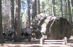
Calaveras Big Trees State Park
Arnold, California
41.0 miles SETwo groves of towering Giant Sequoias — about 100 trees in the North Grove and 1,000 in the South Grove — with boardwalk trails, a famous 24-foot stump you can walk on, and great spring hiking in Northern California gold country.
Hike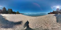
Lester Beach
South Lake Tahoe
41.9 miles NELester Beach is the sandy main swim beach at D. L. Bliss State Park on Lake Tahoe's west shore, with clear, cold, shallow water and a $10 per vehicle day-use fee in season.
Camp, Canoe, Hike, Kayak, Swim
Jones Bar
Nevada City
42.2 miles NWA primitive South Yuba River swimming hole at the mouth of Rush Creek in South Yuba River State Park, reached by a steep trail from the Independence Trail lot on Highway 49 or a rough 4WD road. No fee posted at the bar.
Hike, Swim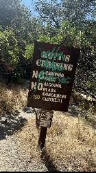
Hoyt's Crossing
Nevada City
42.4 miles NA deep pool and boulder beach on the South Yuba River in South Yuba River State Park, reached by a 0.75-mile walk on the Hoyt Trail from the Highway 49 bridges north of Nevada City. Free to walk in.
Hike, Swim 0.1 mi
Edwards Crossing
Nevada City, California
42.7 miles NDeep blue water, rock cliffs, and a sandy beach on the Yuba River — with a half-mile walk from the parking lot and cliff jumping spots up to 20 feet deep.
Hike, Swim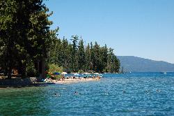
Sugar Pine Point Beach
Tahoma
43.1 miles NEA quarter-mile walk from the parking lot puts you on a sand beach at the foot of Ed Z'berg Sugar Pine Point State Park, where General Creek meets Lake Tahoe and the water runs clear enough to read the bottom. It is also genuinely cold, even in August.
Camp, Hike, Kayak, Swim
Shirley Canyon
Olympic Valley, California
44.0 miles NEShirley Canyon is widely regarded as one of Lake Tahoe's finest half-day hikes, a spectacular climb up a granite canyon that rises straight out of the base of the Palisades Tahoe ski resort in...
Hike
Palisades Creek Trail
Truckee, California
44.0 miles NEA difficult Sierra Nevada trail past Palisade Falls — one of the tallest on the American River — with views of Devils Peak, alpine lakes, and 2,000 feet of elevation gain.
Hike, Swim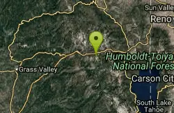
Heath Falls Overlook Trail
Truckee, California
44.0 miles NEHike and Swim near Truckee, California
Hike, Swim 4.1 mi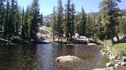
Shirley Lake Canyon Trail
Olympic Valley, California
44.1 miles NEA 2.5-mile hike from Squaw Valley Village past streams and waterfalls to a pure Sierra lake — rocky near the top, with a free gondola ride back down from High Camp as a reward.
Hike, Swim


