


242 Things to do near Red Rock Trail
first prev 1 2 3 4 5 6 7 8 9 10 next lastShowing results within 50 miles Distance miles of 1150 Sunset Dunes Way, Draper, UT 84020, USA City, Zip, or Address
Saratoga Hills
Saratoga Springs, Utah
10.9 miles SFirst 3 holes very short. Open and flat. Please minimize noise and do not litter. Private (No Fee)
Disc Golf
Bonneville Shoreline Trail - Cedar Hills to Grove Creek Canyon
Pleasant Grove, Utah
10.9 miles SEThe Cedar Hills to Grove Creek Canyon portion of the Bonneville Shoreline Trail is an intermediate level trail. There are some flat spots that are on old dirt roads, as well as single track...
Mountain Bike
Grove Creek Trail
Pleasant Grove, Utah
11.0 miles SEThe Grove Creek Trail falls from the upper shoulder of Mount Timpanogos down Grove Creek Canyon to Pleasant Grove. It's usually ridden as a shuttled downhill -- because the climb up this...
Hike, Mountain Bike 0.4-0.5 mi
Mountain Ranch Bike Park
Eagle Mountain, Utah
11.0 miles SWMountain Ranch Bike Park takes great advantage of that otherwise unusable strip of land underneath large power lines. There is tons of single track thoughout the area but the bike park offers...
Mountain Bike
Pfeiferhorn Peak
Provo, Utah
11.1 miles NEThe Pfeifferhorn is a majestic peak, which is located east of Salt Lake City, Utah in the Wasatch mountain range. It's easy access, proximity to alpine lakes and short trail make it a popular...
Backpack, Hike
Tibble Fork Reservoir
Provo, Utah
11.2 miles EThere isn't one specific sledding run at this location. There's a great parking lot and hills above and below. It all depends on what kind of speed and excitement you're looking for....
Sled
Tibble Fork
Provo, Utah
11.2 miles EThis trail is advanced tech and strenuous aerobic. This trail involves a few miles of riding on the pavement. Start by heading back down to the intersection with the South Fork of American Canyon and...
Mountain Bike
Storm Mountain
Salt Lake City, Utah
11.2 miles NEStorm Mountain is on of the smaller peaks included in the Wasatch Range. Storm Mountain is located in Cottonwood Canyon. Storm Mountain Day Use Area is just 3 miles up Big Cottonwood Canyon,...
Hike, Mountain Bike, Rock Climb
Sandpiper Hill
Eagle Mountain, Utah
11.3 miles SWThis is a great hill big enough to deal with just about any crowd it might get. It's a long slope that'll keep your kids going but doesn't get too insanely fast that you need to worry...
Sled 0.2 mi
Kiowa Valley Path
Eagle Mountain, Utah
11.3 miles SWAt 0.3 miles, this short little hike is almost more of a quick dog walk but kids seem to enjoy the lizards and rabbits that frequent the path. The lizards seem to enjoy basking in the heat of the...
Hike

American Fork Twin Peaks
Provo, Utah
11.5 miles NEAmerican Fork Twin Peaks is the highest mountain on the Little Cottonwood Canyon ridge. The summit is the prominent peak overlooking the Snowbird ski resort. A short approach hike...
Hike
Bear Canyon Loop
Provo, Utah
11.6 miles EA route for the thrill seeker, the Bear Canyon Loop is an advanced mountain biking route. This a challenging route and should be done only by those who know how to handle their bike on steep rocky...
Mountain Bike
Pete's Rock
Salt Lake City, Utah
11.8 miles NA large rock next to the Mount Olympus trailhead known locally as Pete's Rock and is a popular place for casual rock climbing. Mount Olympus is a prominent 9,026 feet peak on the east side of the...
Hike, Rock Climb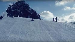
Murray Park
Murray, Utah
11.9 miles NSled near Murray, Utah
Sled
G Mountain Trail
Pleasant Grove, Utah
11.9 miles SEThe trail starts at Kiwanis Park which is south of the 'G' at the end of Battle Creek Road. The trail starts out a little steep for about .25 mile and the very last bit is a...
Hike 1.2 mi
Battle Creek Falls
Pleasant Grove, Utah
11.9 miles SEBattle Creek Falls, located near Pleasant Grove, Utah, is a scenic waterfall that also has a rappelling and rock climbing area nearby. Hikers are allowed to see the falls from two view points, below...
Canyoneer, Hike
Lake Blanche
Salt Lake City, Utah
11.9 miles NELake Blanche is a fun and popular hike. Lake Blanche, Lake Florence and Lake Lillian are all located next to each other in the upper reaches of the South Fork of Mill B. The trail to Lake Blanche...
Hike
Yellow Fork Canyon
Herriman, Utah
12.0 miles WYellow Fork is a surprisingly nice trail in the Oquirrh Mountain foothills at Rose Canyon. Among the many options are two main choices: there's a nice 7-mile singletrack loop ride with 1300...
Mountain Bike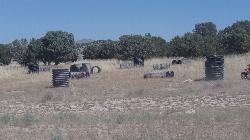
Eagle Mountain Paintball Field
Eagle Mountain, Utah
12.0 miles SWJust south of the Eagle Mountain trailhead, there's a great outcropping of bushes and brush that's been built up as a paintball field with a bunch of corrugated culvert pipe. There's a...
Airsoft, Paintball 1.6-14.1 mi
Mount Timpanogas
Provo, Utah
12.1 miles EMt. Timp, as the locals call it, is the 2nd highest mountain in the Wasatch range (only Mt. Nebo is higher). What sets "Timp" apart is its location. It towers over the Provo, Orem, Pleasant...
Camp, Hike, Horseback, Swim


