


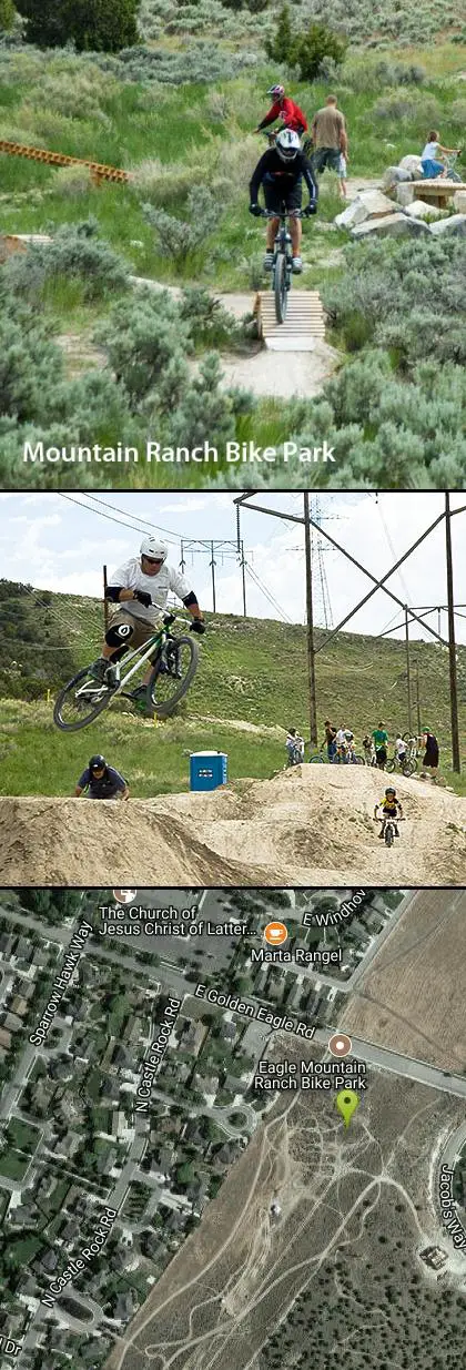
Mountain Ranch Bike Park
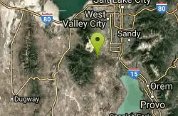
Eagle Mountain, Utah
| Address: | 3450 E Golden Eagle Rd, Eagle Mountain, UT 84005, USA |
| GPS: |
40°21'22.9"N 111°58'42.2"W Maps | Directions |
| State: | Utah |
| Trails/Routes: | 0.4-0.5 mi |
Motorized Use
Mountain Bike
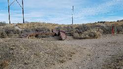
Mountain Ranch Bike Park takes great advantage of that otherwise unusable strip of land underneath large power lines. There is tons of single track thoughout the area but the bike park offers some great features. At the base, there's a skills park for all ages to practice jumps, drops, ladders, and berms.
The first skills section you'll see is the ladder park. With over 400 feet of ladders and rock features, you'll be able to practice everything from basic balance to balancing on berms and climbs to riding technical rock features and executing drops. There's even just some plain boards for practicing some skinnies.
The next park is a very small little bike park for the kiddies. It's complete with jumps and berms but nothing is over 2 feet high.
The most popular section of the skills park is the jump track which features 5 sets of table tops, each with 3 sizes of jumps. The first set has a jump to the side so you can gap over to the actual table top and the last of the larger jumps has a very small gap.
There are 3 official trails in the park. Each uses the same bike path and access road to get to the top and each of them ends back at the ladder park.
- 110 is rated Beginner and is flowy with ladders. There are a few jumps under 2 feet and a few optional ladder features.
- 220 is rated Intermediate and is actually fairly technical compared to Juniper, which is marked as Advanced. There are several optional ladders and several more technical areas of rock to climb and descend. Navigating the intermediate trail can be tricky as well as there are many optional routes that do not all lead back into the main trail. For the most part, there isn't a ton of slope up or down.
- Juniper is rated Advanced likely due to the slope and speed. You'll find plenty of flow, jumps, and speed. There are a couple of table tops and a couple of small kickers. At the beginning of the trail, there's a pretty serious drop with a rocky landing that leads immediately into a berm. After that, it's pretty mellow. There's not a lot of optional features but there are no gap jumps and nothing that couldn't be rolled over if it looked like it was too much.
Local Information
- Restrooms are located at Nolan Park (one block west and 1/2 block north) and at the gas station at the Pony Express, Ranches Parkway intersection.
- Parking Please do not park in front of private residences. If there is no parking on golden eagle please park by Nolan Park (one block West) Eagle Mountain and The Ranches are bike friendly communities with lots of trailways. Please consider riding your bike next time.
- Food and services are available at the corner of Ranches Parkway and Pony Express Parkway. The trail across the road to the north can take you there
- Please stay off of private property and electrical towers
- Trash cans are located in the skills area and at the trailhead. Please use them for all of your garbage needs.
- Get involved If you can volunteer some time for maintenance of this park, or you have any suggestions contact us at waftautah.com
Rules
- Ride at your own risk. Jumps and technical trail features in this park may be dangerous. Accidents and injuries can occur. Ride within your limits.
- This park is not supervised. You are responsible for your own safety.
- Protective helmets. Gloves knee pads, and elbow pads are strongly recommended.
- Park hours are dawn to dusk unless the area is posted closed for construction or repairs
- Bicycles only. No motorized vehicles are allowed.
- Ride responsibly. Stay in control of your bike at all times. Only ride features that match your ability.
- Use caution and know your limits. Start small and develop your skill level before advancing. Inspect all features and jumps before riding.
- Be considerate of neighbors and other park users, especially children.
- Ride only on designated areas and trails. If the soil is muddy please do not ride in this area.
- Rain and wind increase the risk of technical features and jumps. Please use extra caution in these conditions.
- Unauthorized features and jumps are prohibited. Please do not make alterations to the trail or park features. All changes must be approved and reviewed by Eagle Mountain City Parks Department.
- Ride don't slide. Skidding damages jumps and trails. Please ride responsibly.
- The City of Eagle Mountain is not responsible for injuries to park users or for damage or theft of personal property.
Never modify trail features. Ride trails when they're dry enough that you won't leave ruts. Speak up when you see others on the trail and always yield to hikers, horses, and others coming uphill. Always ride on the established trail.
Read More- Plan Ahead and Prepare
- Travel & camp on durable surfaces
- Dispose of waste properly
- Leave what you find
- Minimize campfire impacts
- Respect wildlife
- Be considerate of other visitors
Directions
From Eagle Mountain, Utah
- Head east on S Independence Way toward Revere Way (433 ft)
- Continue onto Church Way (0.1 mi)
- At the traffic circle, take the 1st exit (190 ft)
- Turn left onto Bobby Wren Blvd (0.3 mi)
- Turn right at the 1st cross street onto Pony Express Pkwy/Sweetwater NContinue to follow Pony Express Pkwy(3.6 mi)
- Turn right onto Tinamous Rd (0.2 mi)
- Turn right onto E Golden Eagle RdDestination will be on the right(0.3 mi)
Park on Golden Eagle Road just below the park and walk up the stairs or take one of the trails into the park. You won't be able to see the park from the road but there is a sign there to mark the location. Please do not park in front of people's homes. If there's no parking on Golden Eagle, please park by Nolan Park (1 block West and 1/2 block North).
 Skill Ladders courtesy of endovereric↗

 Mountain Ranch Bike Park 2
 Park Map Sign
 Skills Area courtesy of endovereric↗
 Skills Area Jump Track courtesy of endovereric↗
 Skills Area Kiddie Track courtesy of endovereric↗
 Skill Ladders courtesy of endovereric↗
 Skill Ladders courtesy of endovereric↗
 Ladder Park Features courtesy of endovereric↗
 Ladder Park Features courtesy of endovereric↗
 Ladder Park Features courtesy of endovereric↗
 Drop at the end of Trail 220 courtesy of endovereric↗


Other Mountain Bike Trails Nearby
Yellow Fork Canyon
Herriman, Utah
9.4 miles NWA 7-mile singletrack loop through oak trees in Rose Canyon with 1,300 feet of climbing — or a smooth 2-mile doubletrack ride in Yellow Fork Park to a lovely picnic area by a stream.
Mountain Bike 1.3 mi
Eagle Crest Trail
Draper, Utah
11.0 miles NEA beginner-level 2.4-mile mountain bike trail along the north side of Traverse Mountain in Draper, with sweeping views of Salt Lake Valley, Mount Timpanogos, Lone Peak, and Box Elder Mountain.
Hike, Mountain Bike 0.8 mi
Red Rock Trail
Draper, Utah
11.0 miles NEA one-mile cliff-edge loop delivers sweeping Salt Lake Valley views and beginner-to-intermediate rock climbing on five walls with dental-themed route names.
Hike, Mountain Bike, Rock Climb
Little Valley Trail
Draper, Utah
11.3 miles NESuperbly constructed flow trails in a small Draper valley that are just as fun for adults as for kids — with connections to Corner Canyon for a longer ride.
Hike, Mountain Bike 0.6 mi
Potato Hill Trail
Draper, Utah
11.4 miles NEA short, paved trail system in Draper that connects Potato Hill to the Bonneville Shoreline Trail — combine with Red Potato and Lexie and Ethan trails for a 3-mile loop with smooth climbing.
Hike, Mountain Bike
Mercer Hollow Trail
Draper, Utah
11.7 miles NEA fast, flowy descent on the southern flank of Corner Canyon Ridge, packed with berms, rock features, rollers, and a quick uphill that rewards you on the way back down.
Hike, Mountain Bike 1.6 mi
Corner Canyon Trail
Draper, Utah
12.4 miles NEA go-to mountain biking area in South Salt Lake mixing beginner training trails in Little Valley with big table tops and wall rides in Maple Hollow.
Backpack, Hike, Mountain Bike 0.6 mi
Bst To Equestrian Center Loop
Draper, Utah
12.4 miles NEA 10-mile intermediate singletrack loop in Draper connecting the Bonneville Shoreline Trail and Equestrian Center with 417 feet of elevation along varied terrain.
Hike, Mountain Bike 0.2-1.8 mi
Lone Peak
Draper, Utah
12.8 miles NEOne of the Wasatch Front's taller peaks at over 11,000 feet, Lone Peak offers five different trailhead approaches, a 9-mile average round trip, rugged canyon terrain, and stunning Salt Lake valley views.
Hike, Mountain Bike, Rock Climb 1.2 mi
Ghost Falls Trail
Sandy, Utah
12.8 miles NEA family-friendly hike in Corner Canyon that winds through sandy rocky slopes and dry creek beds to the Ghost Falls loop, with helpful trail signs at the confusing intersections.
Hike, Mountain Bike, Snowshoe 1.7 mi
Jacob's Ladder Trail
Sandy, Utah
12.8 miles NEJacob's Ladder is the steep, relentless local favorite for climbing into the Lone Peak Wilderness above Draper, Utah — and a legendary technical descent.
Hike, Mountain Bike 0.8 mi
Bear Canyon Suspension Bridge
Draper, Utah
13.7 miles NEA 4.5-mile moderate hike in Draper connecting to a 185-foot suspension bridge over Bear Canyon, with sweeping Salt Lake Valley views and dozens of additional trails branching off nearby.
Hike, Mountain Bike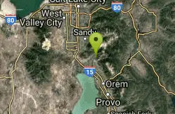
Rodeo Down
Alpine, Utah
13.7 miles NEA dense network of named mountain bike trails in Alpine — Black Dog, Brown Dog, Corkscrew, Flank, and more — with varied technical character, rock stunts, and elevation changes up to 300 feet.
Mountain Bike
Bonneville Shoreline Trail - Cedar Hills to Grove Creek Canyon
Pleasant Grove, Utah
14.1 miles EA 3-mile intermediate mountain bike trail along the Bonneville Shoreline, connecting Cedar Hills to Grove Creek Canyon — mostly flat with some singletrack and a few intersecting routes near construction.
Mountain Bike 0.2 mi
Orson Smith trail
Draper, Utah
14.1 miles NEA short Draper foothills trail leading to a popular suspension bridge completed in 2015 at Bear Canyon — connecting to the Bonneville Shoreline Trail and open to hikers, bikers, and bird watchers.
Hike, Mountain Bike
Grove Creek Trail
Pleasant Grove, Utah
14.2 miles EA steep, shuttled downhill singletrack dropping from the shoulder of Mount Timpanogos through Grove Creek Canyon — the climb is brutal, but the descent is worth it.
Hike, Mountain Bike 1.7 mi
Schoolhouse Springs Trail
Alpine, Utah
14.4 miles NEA short, scenic trail at 5,300 feet in Alpine, Utah, featuring a lake and activities from horseback riding to hiking — best enjoyed between May and October.
Hike, Mountain Bike 0.4 mi
Hidden Valley Park trail
Sandy, Utah
15.4 miles NEA hidden shallow valley of grass, sandstone cliffs, and Navajo Sandstone domes just south of Moab — loop options total about one mile, but bring water because it gets hot.
Hike, Mountain Bike 1.1-4.7 mi
Bells Canyon
Sandy, Utah
17.1 miles NEA 4.5-mile moderate hike up to a canyon waterfall through gorgeous fall foliage, meadows, wildflowers, and a creekside trail — the last 1.2 miles involve serious climbing over large rocks.
Backpack, Hike, Mountain Bike, Snowshoe
South Fork of the Provo
Provo, Utah
17.7 miles EA fun, short, scenic singletrack ride on the South Fork of the Provo — ideal for introducing new riders to mountain biking, with a loop at the end and an optional extension past Big Spring.
Mountain BikeNearby Campsites

Mount Timpanogas
Provo, Utah
18.6 miles EUtah's most-climbed mountain towers 7,000 feet above the Provo valley, stretching seven miles north to south with multiple peaks over 11,000 feet — a Wasatch landmark.
Camp, Hike, Horseback, Swim
Y-Mountain Summit Trail
Provo, Utah
21.0 miles EA 1.2-mile climb east of BYU leads to a massive block Y on the hillside and sweeping panoramas over Provo, Orem, Utah Valley, and Utah Lake below.
Camp, Hike
Spruces Campground
Salt Lake City, Utah
26.5 miles NEA fee campground in Big Cottonwood Canyon near Salt Lake City — check USDA.gov for current rates and seasonal availability.
Camp, Sled
Mill Creek Canyon
Salt Lake City, Utah
27.5 miles NEAn out-and-back canyon trail with over 1,000 feet of elevation gain — the lower ski trail sees heavy traffic while the upper section above Elbow Fork stays quiet, with a reservable Yurt at the top December through April.
Camp, Cross-country Ski, Snowshoe
Holbrook Trailhead
Bountiful, Utah
37.0 miles NThe Holbrook Trailhead is a popular access point for the Bonneville Shoreline Trail and Holbrook Canyon above Bountiful, Utah, on the western face of the Wasatch. Perched on the bench right at the...
Airsoft, Backpack, Camp, Paintball, Snowshoe 4.7 mi
Fifth Water Hot Springs
Provo, Utah
37.9 miles SEA scenic 2.5-mile riverside hike to the famous Diamond Fork rock pools and waterfall, with soaks up to 108°.
Backpack, Camp, Hike, Hot Springs, Mountain Bike, Swim
Antelope Island State Park
Syracuse, Utah
48.4 miles NTwenty miles of trails cross Utah's Great Salt Lake island alongside free-roaming bison, antelope, and bobcats — best visited in early spring or late fall to beat the bugs.
Backpack, Camp, Hike, Horseback, Mountain Bike 5.6 mi
Antelope Island Lakeside Trail
Syracuse, Utah
48.5 miles NAn easy 2-hour loop on Antelope Island around the Great Salt Lake, with rock formations, views of the Sierra Nevadas, and the GSL — kid-friendly and good for bug fans.
Camp, Hike, Horseback


