


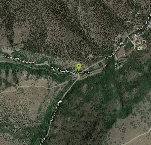
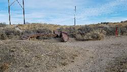
Yellow Fork Canyon
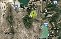
Herriman, Utah
| Address: | ~15628 Rose Canyon Rd, Herriman, UT 84096, USA |
| GPS: |
40°27'55.9"N 112°5'4.4"W Maps | Directions |
| State: | Utah |
| Trail Length: | 9.00 miles |
| MTB Difficulty: | Intermediate |
| Trail Type: | Out & Back |
| MTB Trail Type: | Singletrack |
Mountain Bike
Yellow Fork is a surprisingly nice trail in the Oquirrh Mountain foothills at Rose Canyon. Among the many options are two main choices: there's a nice 7-mile singletrack loop ride with 1300 vertical feet of climbing, and there's a smooth 2-mile doubletrack ride in Yellow Fork Park that goes to a lovely picnic area.
Yellow Fork is a great twisting singletrack through the oak trees. It is relatively low in technical difficulty and does not climb at to steep of a grade. It would make an excellent introductory ride on singletrack trails! It does get a bit narrow up at the top, which helps you learn to hold a line! About 1.5 miles into the ride you will make a very sharp right-hand hairpin turn around a fallen tree. The trail turns to a double track here. Stay right on the double track for .4 of a mile. You will see the singletrack continuing off to your right. Follow the narrow singletrack up the the scrub oak until you hit the doubletrack again. Look to your left, about 20 yards down the doubletrack, and you will see the singletrack again. From here to the top you will climb rather steep, narrow sections through the aspens! The trail turns north and breaks out into the open for a great view of the Wasatch Front and the Kennecott Copper Mine. From here on, we haven't had the time to explore...your on your own!! Courtesy of Singletracks.com
More Information
Add ResourceNever modify trail features. Ride trails when they're dry enough that you won't leave ruts. Speak up when you see others on the trail and always yield to hikers, horses, and others coming uphill. Always ride on the established trail.
Read More- Plan Ahead and Prepare
- Travel & camp on durable surfaces
- Dispose of waste properly
- Leave what you find
- Minimize campfire impacts
- Respect wildlife
- Be considerate of other visitors
Directions
From Herriman, Utah
- Head west on W 13100 S/Main St toward S 6000 W/S Pioneer St (0.6 mi)
- Turn left onto S 6400 W/Rose Canyon Rd (1.0 mi)
- Turn right onto Rose Canyon Rd (1.4 mi)
- Turn left to stay on Rose Canyon RdDestination will be on the right(2.1 mi)
From I-15, take the Bangerter Highway and head west. After the highway curves north, turn left on 126th south (traffic light and big pedestrian overpass) at mile 6.0. 126th becomes 131st. In Herriman, turn left on Rose Canyon Road. Set odometer. 0.9 mile later, turn right at stop sign, then keep left at 2.3 to continue on Rose Canyon Road. At mile 4.4, pavement ends at the creek. Find a parking spot. The trail begins right along the creek, going uphill.
Other Mountain Bike Trails Nearby
Mountain Ranch Bike Park
Eagle Mountain, Utah
9.4 miles SEMountain Ranch Bike Park takes great advantage of that otherwise unusable strip of land underneath large power lines. There is tons of single track thoughout the area but the bike park offers...
Mountain Bike 0.8 mi
Red Rock Trail
Draper, Utah
12.0 miles EThe Red Rock trail located in Draper, Utah is a short loop trail just down the road from the Draper LDS Temple. The hike itself may be short, but since it is along the cliffs of the southern end of...
Hike, Mountain Bike, Rock Climb
Little Valley Trail
Draper, Utah
12.4 miles EOne of the best places in the Salt Lake valley to take kids mountain biking is the Little Valley Instructional Trails. Fortunately, these superbly constructed “flow” trails are just as...
Hike, Mountain Bike 0.6 mi
Potato Hill Trail
Draper, Utah
12.5 miles ELocated in Draper, UT, Potato Hill Trail start at the trailhead on Transverse Mountain Road. and goes down to the (BST) or Bonneville Shoreline Trail west of Coyote Hollow. There are some trails that...
Hike, Mountain Bike 1.6 mi
Corner Canyon Trail
Draper, Utah
12.7 miles ECorner Canyon is the "Go To" riding area in South Salt Lake and for many riders it is worth the drive (or ride) from Utah County. It is a good mix of everything from beginner training...
Backpack, Hike, Mountain Bike 0.6 mi
Bst To Equestrian Center Loop
Draper, Utah
12.8 miles EAn intermediate trail with a length of 10 miles that's located in Draper, UT. It's a single track look trail that has an elevation of 417 ft. Start at the Equestrian Center and follow the...
Hike, Mountain Bike 1.3 mi
Eagle Crest Trail
Draper, Utah
13.1 miles EEagle Crest trail is a beginner level trail mountain bike in Draper, Utah along the north side of Traverse Mountain. From the trail, riders can see the Salt Lake Valley, the Northern end of Utah...
Hike, Mountain Bike 0.8 mi
Bear Canyon Suspension Bridge
Draper, Utah
13.7 miles EThe Bear Canyon Suspension Bridge is a 185ft bridge that connects the Bear Canyon to the Bonneville Shoreline Trail. The bridge was built and completed in 2015 thanks to donations from residents and...
Hike, Mountain Bike
Mercer Hollow Trail
Draper, Utah
13.7 miles EMercer Hollow Trail is primarily used to bomb down the southern flanks of the ridge the Corner Canyon Trails sit on. It's filled with berms, rock features, rollers, and sweet, sweet...
Hike, Mountain Bike 1.2 mi
Ghost Falls Trail
Sandy, Utah
14.2 miles EGhost Falls is located in the corner canyon riding area of Draper, Utah and one of the first mountain bike routes in the canyon. It's a family-friendly hike, named for the...
Hike, Mountain Bike, Snowshoe 0.2-1.8 mi
Lone Peak
Draper, Utah
14.2 miles EEstablished in 1978 and located southeast of Salt Lake, Lone Peak is one of the taller peaks in the Wasatch range along the Wasatch Front. It has 5 main trailheads: Jacobs Ladder via Corner Canyon...
Hike, Mountain Bike, Rock Climb 1.7 mi
Jacob's Ladder Trail
Sandy, Utah
14.2 miles EJacobs Ladder trail has an elevation trail of 5,700 ft. and the most popular trailhead out of the five trails in Lone Peak. It's located near a large area on the right side of the road...
Hike, Mountain Bike 0.2 mi
Orson Smith trail
Draper, Utah
14.3 miles EOrson Smith Trail is located north of the Corner Canyon Gate. It leads up to the suspension bridge and has become a popular spot for hiking and bike routes since the suspension...
Hike, Mountain Bike 0.4 mi
Hidden Valley Park trail
Sandy, Utah
15.1 miles EHidden Valley Trail has different levels and gradual uphill fun and makes for a good adventure trail. It's a wide, shallow valley that is hidden from view; hence the name. The valley’s...
Hike, Mountain Bike 1.1-4.7 mi
Bells Canyon
Sandy, Utah
16.3 miles NEBells Canyon is a moderate, 4.5 mile hike that begins in a residential area and ends at a waterfall in the enter of the canyon's forest. The first 1/2 mile of the hike is relatively...
Backpack, Hike, Mountain Bike, Snowshoe 1.7 mi
Schoolhouse Springs Trail
Alpine, Utah
17.1 miles ESchoolhouse Springs trail has an elevation trail at 5,300 ft. It's located at the end of the town of Alpine. It features a lake and there's a number of activities including horse-back...
Hike, Mountain Bike
Rodeo Down
Alpine, Utah
17.4 miles EBlack Dog. Trail winds from the middle of Corkscrew down to Flank and River, just south of the water tank. Some technical aspects, length 0.5 miles with 300 vertical feet elevation...
Mountain Bike 3.2 mi
Little Cottonwood Pipeline Trail
Sandy, Utah
17.9 miles NELocated in Sandy, UT, Little Cottonwood Pipeline trail starts at the mouth of Little Cottonwood Canyon and is a single-track trail with some rocky situations on the trail. The first portion of the...
Mountain Bike
Ferguson Canyon
Cottonwood Heights, Utah
18.5 miles NEFerguson canyon is small canyon between Big and Little Cottonwood Canyons. This canyon has gained popularity over the last few year and is a popular destination for rock climbers. This is one hike...
Hike, Mountain Bike, Rock Climb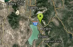
Bonneville Shoreline Trail - Cedar Hills to Grove Creek Canyon
Pleasant Grove, Utah
20.6 miles EThe Cedar Hills to Grove Creek Canyon portion of the Bonneville Shoreline Trail is an intermediate level trail. There are some flat spots that are on old dirt roads, as well as single track...
Mountain BikeNearby Campsites

Mount Timpanogas
Provo, Utah
23.6 miles EMt. Timp, as the locals call it, is the 2nd highest mountain in the Wasatch range (only Mt. Nebo is higher). What sets "Timp" apart is its location. It towers over the Provo, Orem, Pleasant...
Camp, Hike, Horseback, Swim
Mill Creek Canyon
Salt Lake City, Utah
25.3 miles NEMill Creek is an out and back with over 1000 ft of elevation gain. The lower section of the ski trail gets a lot of foot traffic, but the upper section (above Elbow Fork) is generally very quiet....
Camp, Cross-country Ski, Snowshoe
Spruces Campground
Salt Lake City, Utah
26.3 miles NECamping isn't free. See USDA.gov for details. If you know the coordinates of the sledding hill here, please comment.
Camp, Sled
Y-Mountain Summit Trail
Provo, Utah
29.4 miles SEY Mountain is located directly east of Brigham Young University (BYU) in Provo, Utah, United States. The Slide Canyon/Y Mountain Trail leads to a large block Y located 1.2 miles (1.9 km) from a...
Camp, Hike
Holbrook Trailhead
Bountiful, Utah
31.4 miles NEairsoft feaild woth bunkers
Airsoft, Backpack, Camp, Paintball, Snowshoe
Antelope Island State Park
Syracuse, Utah
39.7 miles NLocated just 41 miles north of Salt Lake City, Antelope Island State Park encompasses a vast selection of outdoor activities and spectacular scenery providing a peaceful nature experience. Experience...
Backpack, Camp, Hike, Horseback, Mountain Bike 5.6 mi
Antelope Island Lakeside Trail
Syracuse, Utah
39.9 miles NThe Lakeside Trail is a kid-friendly trail with great views and many bugs. This is a gorgeous scenic hike winding around part of the Great Salt Lake. The trail on Antelope Island that runs about...
Camp, Hike, Horseback 4.7 mi
Fifth Water Hot Springs
Provo, Utah
46.7 miles SEAKA Diamond Fork Hot Springs A beautiful drive and a 2.5 mile hike along the river will end you at an amazing set of hot springs that's well worth the trip. There's a variety of...
Backpack, Camp, Hike, Hot Springs, Mountain Bike, Swim


