


Wild Plum Campground
Sierra City

Camp, Hike, and Swim
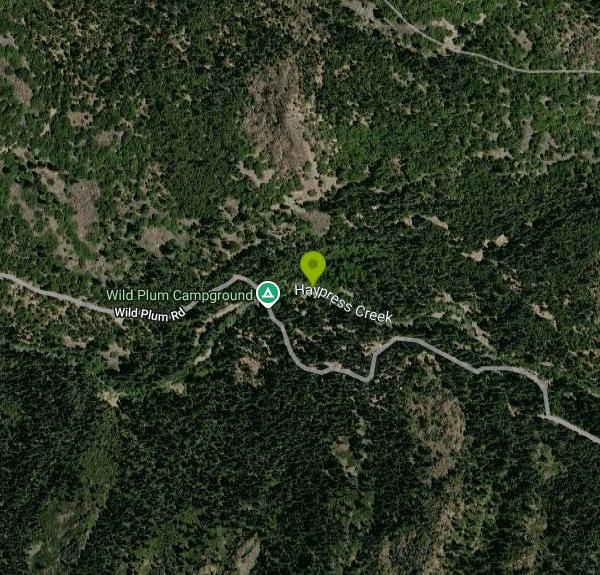
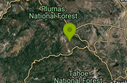
Wild Plum Campground is a Tahoe National Forest campground on Haypress Creek, about a mile east of Sierra City in Sierra County. The Yuba River Ranger District runs it, and the Forest Service lists swimming among its recreation opportunities. Haypress Creek is a small, rocky mountain stream that drains the slopes south of town and joins the North Yuba River a short distance below the campground. The lower loop sits right on the creek bank under pine and hardwood shade, and the ground is strewn with cobbles left by gold dredging more than a century ago.
From Highway 49 just east of Sierra City, turn south onto Wild Plum Road at the campground sign. The road crosses the North Yuba and climbs gently along Haypress Creek for about a mile and a half. Day visitors can use the Forest Service trailhead parking area on Wild Plum Road just outside the campground, which also serves the Wild Plum Loop Trail and the Pacific Crest Trail. From there it is a short walk to the creek and the one-lane bridge at the campground entrance. Campsite spurs are for registered campers, so leave them alone if you are only coming to swim.
Swimming here is informal. There is no beach, no buoyed area and no lifeguard. You wade or slip into pools between boulders, and the best water is along the lower loop and in the stretch just above and below the bridge. Depths change from year to year as winter flows move rock around, so check any pool on foot before jumping. The creek is fed by snowmelt from the high country above it and stays cold all summer. Early in the season it runs fast, loud and dangerous; by August and September the flow drops and the pools become usable for a cold dip.
The Forest Service publishes fees for overnight use only: $24 per night for a single site and $5 per night for each additional vehicle, paid in cash or check at the self-pay station. No day-use fee is posted for the trailhead lot or for walking to the creek. The campground season runs May 20 to October 15, with quiet hours from 10 p.m. to 6 a.m., and the site is listed as closed outside that window. Snow covers this area in winter, so plan on summer and early fall.
Bears are active in this drainage and every campsite has a bear-proof food locker, so do not leave food or coolers in your car. There is no cell service at the campground; the nearest reliable signal is in Sierra City or Downieville. Fire restrictions can come into force at any time in hot weather. The rocks along the bank are slick, and a slip into fast spring water is the main real hazard here.
The 2.5-mile Wild Plum Loop Trail leaves from the campground, climbs to the Pacific Crest Trail and links with the Haypress Trail, and a longer walk on the PCT reaches the deep pools at Loves Falls on the North Yuba. Sierra City, two miles back down the road, has food, lodging and the Kentucky Mine and Sierra County Historical Park. Sardine Lakes and the Gold Lakes Basin, about seven miles north, are the next swimming options if the creek is running too high.
More Information
Be courteous, informed, and prepared. Read trailhead guidelines, stay on the trail, and don't feed the wildlife.
Read More
- Plan Ahead and Prepare
- Travel & camp on durable surfaces
- Dispose of waste properly
- Leave what you find
- Minimize campfire impacts
- Respect wildlife
- Be considerate of other visitors
Directions
From Sierra City
- Head northeast on CA-49 S toward Church St (0.4 mi)
- Turn right onto Wild Plum RdDestination will be on the left(1.4 mi)


Other Swimming Holes and Hiking Trails Nearby
Goose Lake
Graeagle
7.7 miles NA small, quiet Plumas National Forest lake beside the Gold Lake Highway in the Lakes Basin, with free informal swimming from the shore and a 13-site Forest Service campground on its banks.
Camp, Canoe, Hike, Kayak, Swim
Gold Lake
Graeagle
8.6 miles NGold Lake is the largest lake in the Plumas National Forest's Lakes Basin Recreation Area, with a free cartop launch and day-use area by the dam on its north shore where swimmers can get in.
Camp, Canoe, Hike, Kayak, Swim
Palisades Creek Trail
Truckee, California
20.4 miles SEA difficult Sierra Nevada trail past Palisade Falls — one of the tallest on the American River — with views of Devils Peak, alpine lakes, and 2,000 feet of elevation gain.
Hike, Swim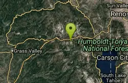
Heath Falls Overlook Trail
Truckee, California
20.4 miles SEHike and Swim near Truckee, California
Hike, Swim
North Fork Falls
Colfax, California
21.6 miles SClear water, cliff-jumping pools, and waterfalls at Sierra Nevada's North Fork Falls — a summer hike to two deep pools with 10-to-25-foot cliffs ready for leaping.
Camp, Hike, Swim
China Cove Beach
Truckee
25.3 miles SEChina Cove Beach is the sandy, shallow corner at the west end of Donner Memorial State Park, on the south shore of Donner Lake outside Truckee. California State Parks runs it, access is open to anyone paying the 10 dollar day use parking fee, and there is
Camp, Canoe, Hike, Kayak, Swim 0.1 mi
Edwards Crossing
Nevada City, California
26.2 miles SWDeep blue water, rock cliffs, and a sandy beach on the Yuba River — with a half-mile walk from the parking lot and cliff jumping spots up to 20 feet deep.
Hike, Swim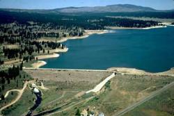
Boca Reservoir Hidden Beach
Truckee, California
29.3 miles ESandy informal beaches on the northeast shore of Boca Reservoir above Truckee, free to use, windy in the afternoons, and drawn down hard by the end of summer.
Camp, Canoe, Kayak, Kiteboard, Swim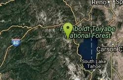
Tahoe Area
Olympic Valley, California
30.8 miles SESwim near Olympic Valley, California
Swim
Shirley Canyon
Olympic Valley, California
31.4 miles SEShirley Canyon is widely regarded as one of Lake Tahoe's finest half-day hikes, a spectacular climb up a granite canyon that rises straight out of the base of the Palisades Tahoe ski resort in...
Hike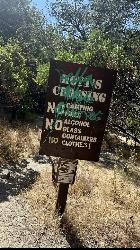
Hoyt's Crossing
Nevada City
31.4 miles SWA deep pool and boulder beach on the South Yuba River in South Yuba River State Park, reached by a 0.75-mile walk on the Hoyt Trail from the Highway 49 bridges north of Nevada City. Free to walk in.
Hike, Swim 4.1 mi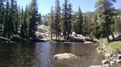
Shirley Lake Canyon Trail
Olympic Valley, California
32.0 miles SEA 2.5-mile hike from Squaw Valley Village past streams and waterfalls to a pure Sierra lake — rocky near the top, with a free gondola ride back down from High Camp as a reward.
Hike, Swim
Jones Bar
Nevada City
32.9 miles SWA primitive South Yuba River swimming hole at the mouth of Rush Creek in South Yuba River State Park, reached by a steep trail from the Independence Trail lot on Highway 49 or a rough 4WD road. No fee posted at the bar.
Hike, Swim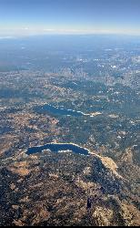
Hell Hole Reservoir
Georgetown
36.4 miles SA 4,630 foot Rubicon River reservoir in the Eldorado National Forest, 51 miles and two hours east of Georgetown, where the boat ramp cove is the only drivable shoreline and the lake drops over 100 feet by September.
Camp, Canoe, Hike, Kayak, Swim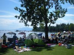
Commons Beach
Tahoe City
36.9 miles SEFree public beach and lakefront park in downtown Tahoe City on Lake Tahoe, run by the Tahoe City PUD, with cold clear water, a sand and cobble shore, kayak rentals and free summer concerts.
Kayak, Swim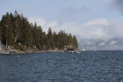
Lake Forest Beach
Tahoe City
37.3 miles SEA free public beach at the end of Bristlecone Street, owned by Placer County and run by the Tahoe City Public Utility District. Sandy, pine shaded and genuinely quiet, with the one real constraint being how few cars fit at the end of the road.
Camp, Canoe, Kayak, Swim
William Kent Beach
Tahoe City
38.1 miles SEA free Forest Service swim beach on Lake Tahoe's West Shore, two miles south of Tahoe City on Highway 89, with a pebbly shore, cold clear water and picnic tables across from William Kent Campground.
Kayak, Swim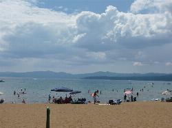
Kings Beach State Recreation Area
Kings Beach
38.4 miles SEA wide sand beach with a shallow, gently sloping entry on Lake Tahoe's north shore, run by California State Parks in downtown Kings Beach. Parking costs $3 an hour or $10 a day, charged year round.
Kayak, Swim
Reno Area
McGill, Nevada
41.9 miles ESwim near McGill, Nevada
Swim
Wingfield Park
Reno, Nevada
42.0 miles EAn oasis in downtown Reno where manmade dams and natural rock formations turn the Truckee River into a playground for swimming, kayaking, tubing, and rafting.
Kayak, SwimNearby Campsites
Goose Lake
Graeagle
7.7 miles NA small, quiet Plumas National Forest lake beside the Gold Lake Highway in the Lakes Basin, with free informal swimming from the shore and a 13-site Forest Service campground on its banks.
Camp, Canoe, Hike, Kayak, Swim
Gold Lake
Graeagle
8.6 miles NGold Lake is the largest lake in the Plumas National Forest's Lakes Basin Recreation Area, with a free cartop launch and day-use area by the dam on its north shore where swimmers can get in.
Camp, Canoe, Hike, Kayak, Swim
North Fork Falls
Colfax, California
21.6 miles SClear water, cliff-jumping pools, and waterfalls at Sierra Nevada's North Fork Falls — a summer hike to two deep pools with 10-to-25-foot cliffs ready for leaping.
Camp, Hike, Swim
China Cove Beach
Truckee
25.3 miles SEChina Cove Beach is the sandy, shallow corner at the west end of Donner Memorial State Park, on the south shore of Donner Lake outside Truckee. California State Parks runs it, access is open to anyone paying the 10 dollar day use parking fee, and there is
Camp, Canoe, Hike, Kayak, Swim
Boca Reservoir Hidden Beach
Truckee, California
29.3 miles ESandy informal beaches on the northeast shore of Boca Reservoir above Truckee, free to use, windy in the afternoons, and drawn down hard by the end of summer.
Camp, Canoe, Kayak, Kiteboard, Swim
Hell Hole Reservoir
Georgetown
36.4 miles SA 4,630 foot Rubicon River reservoir in the Eldorado National Forest, 51 miles and two hours east of Georgetown, where the boat ramp cove is the only drivable shoreline and the lake drops over 100 feet by September.
Camp, Canoe, Hike, Kayak, Swim
Lake Forest Beach
Tahoe City
37.3 miles SEA free public beach at the end of Bristlecone Street, owned by Placer County and run by the Tahoe City Public Utility District. Sandy, pine shaded and genuinely quiet, with the one real constraint being how few cars fit at the end of the road.
Camp, Canoe, Kayak, Swim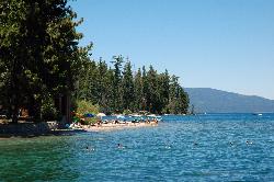
Sugar Pine Point Beach
Tahoma
44.1 miles SEA quarter-mile walk from the parking lot puts you on a sand beach at the foot of Ed Z'berg Sugar Pine Point State Park, where General Creek meets Lake Tahoe and the water runs clear enough to read the bottom. It is also genuinely cold, even in August.
Camp, Hike, Kayak, Swim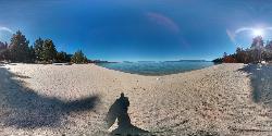
Lester Beach
South Lake Tahoe
47.5 miles SELester Beach is the sandy main swim beach at D. L. Bliss State Park on Lake Tahoe's west shore, with clear, cold, shallow water and a $10 per vehicle day-use fee in season.
Camp, Canoe, Hike, Kayak, Swim


