


51 Things to do near Commons Beach
first prev 1 2 3 next lastShowing results within 50 miles Distance miles of Commons Beach near Tahoe City City, Zip, or Address
Lake Forest Beach
Tahoe City
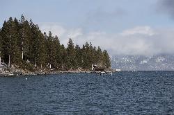
1.6 miles NEA free public beach at the end of Bristlecone Street, owned by Placer County and run by the Tahoe City Public Utility District. Sandy, pine shaded and genuinely quiet, with the one real constraint being how few cars fit at the end of the road.
Camp, Canoe, Kayak, Swim
William Kent Beach
Tahoe City
2.2 miles SA free Forest Service swim beach on Lake Tahoe's West Shore, two miles south of Tahoe City on Highway 89, with a pebbly shore, cold clear water and picnic tables across from William Kent Campground.
Kayak, Swim 4.1 mi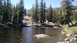
Shirley Lake Canyon Trail
Olympic Valley, California
5.7 miles WA 2.5-mile hike from Squaw Valley Village past streams and waterfalls to a pure Sierra lake — rocky near the top, with a free gondola ride back down from High Camp as a reward.
Hike, Swim
Shirley Canyon
Olympic Valley, California
6.3 miles WShirley Canyon is widely regarded as one of Lake Tahoe's finest half-day hikes, a spectacular climb up a granite canyon that rises straight out of the base of the Palisades Tahoe ski resort in...
Hike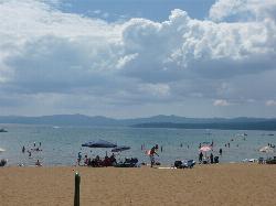
Kings Beach State Recreation Area
Kings Beach
7.7 miles NEA wide sand beach with a shallow, gently sloping entry on Lake Tahoe's north shore, run by California State Parks in downtown Kings Beach. Parking costs $3 an hour or $10 a day, charged year round.
Kayak, Swim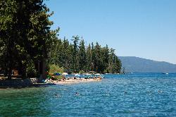
Sugar Pine Point Beach
Tahoma
8.1 miles SA quarter-mile walk from the parking lot puts you on a sand beach at the foot of Ed Z'berg Sugar Pine Point State Park, where General Creek meets Lake Tahoe and the water runs clear enough to read the bottom. It is also genuinely cold, even in August.
Camp, Hike, Kayak, Swim
Truckee Skatepark
Truckee, California
10.9 miles NSkateboard near Truckee, California
Skateboard
Sierra College Truckee
Truckee, California
11.0 miles NA wooded course traversing rolling hills with elevation on every hole — accessible during school hours when the college gate is open.
Disc Golf
Truckee River Regional Park
Truckee, California
11.0 miles NDisc golf on the southern bank of the Truckee River in Truckee, with multiple pin placements, great Sierra views, and a park that also offers fishing, hiking, and mountain biking.
Disc Golf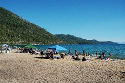
Sand Harbor State Park
Incline Village
11.4 miles EA Nevada State Parks day-use beach on Lake Tahoe's northeast shore near Incline Village, with a 2,500-foot sandy swim beach, very clear cold water and a $10 entry fee ($15 for non-Nevada vehicles).
Hike, Kayak, Swim 1.5 mi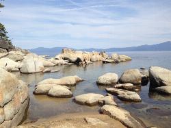
Skunk Harbor
Carson City, Nevada
11.6 miles EA forest service road hike from the 28 freeway to a secluded beach area near Carson City with mountain views, a historic building, and a marker — dogs welcome.
Hike
North Tahoe Lions Club Disc Golf Course
Incline Village, Nevada
11.8 miles NEA short, tight course set along beautiful Third Creek that rewards accuracy over power — funded by local businesses and built by volunteers near Lake Tahoe.
Disc Golf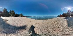
Lester Beach
South Lake Tahoe
11.9 miles SLester Beach is the sandy main swim beach at D. L. Bliss State Park on Lake Tahoe's west shore, with clear, cold, shallow water and a $10 per vehicle day-use fee in season.
Camp, Canoe, Hike, Kayak, Swim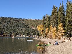
China Cove Beach
Truckee
11.9 miles NWChina Cove Beach is the sandy, shallow corner at the west end of Donner Memorial State Park, on the south shore of Donner Lake outside Truckee. California State Parks runs it, access is open to anyone paying the 10 dollar day use parking fee, and there is
Camp, Canoe, Hike, Kayak, Swim
Vikingsholm Beach
South Lake Tahoe
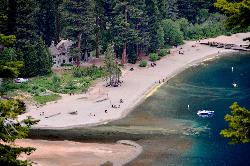
15.2 miles SSandy beach at the head of Emerald Bay in Emerald Bay State Park, below the 1929 Vikingsholm mansion, reached by a steep one-mile trail. Free to walk in; parking is $10 a day.
Hike, Kayak, Swim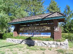
Zephyr Cove Park
Glenbrook, Nevada
15.3 miles SESix tennis courts, disc golf, a sledding hill, a beach, and a fishing pond all at one free park make Zephyr Cove one of Lake Tahoe's most versatile family hangouts.
Camp, Canoe, Disc Golf, Hike, Horseback, Kayak, Swim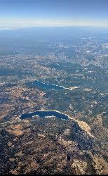
Hell Hole Reservoir
Georgetown
16.5 miles SWA 4,630 foot Rubicon River reservoir in the Eldorado National Forest, 51 miles and two hours east of Georgetown, where the boat ramp cove is the only drivable shoreline and the lake drops over 100 feet by September.
Camp, Canoe, Hike, Kayak, Swim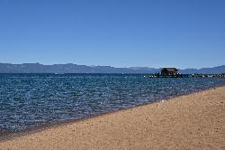
Nevada Beach Campground
Zephyr Cove
16.6 miles SEA mile of wide, coarse granite sand on the Nevada shore of Lake Tahoe, with a long shallow shelf that makes it one of the easiest big beaches on the lake to swim from. The Forest Service concessionaire charges a per vehicle day use fee at the Elks Point R
Camp, Hike, Kayak, Swim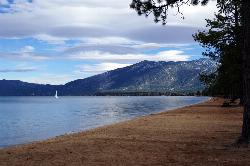
Pope Beach
South Lake Tahoe
17.2 miles SA long sandy Forest Service beach on Lake Tahoe's south shore, three miles northwest of South Lake Tahoe, with clear, cold water and a $10 per vehicle day-use fee.
Kayak, Swim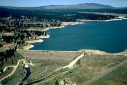
Boca Reservoir Hidden Beach
Truckee, California
17.5 miles NSandy informal beaches on the northeast shore of Boca Reservoir above Truckee, free to use, windy in the afternoons, and drawn down hard by the end of summer.
Camp, Canoe, Kayak, Kiteboard, Swim


