


28.4K Idaho to Utah Stops by endovereric
first prev 1 next last
Mueller Park Trail
Bountiful, Utah
2.9 miles SE of Bountiful, UtahThe Mueller Park Trail is a great year-round trail that's almost right off the road. It's considered moderate difficulty. It's a gradual grade with beautiful views. It's a popular trail in the summer so be prepared to move over for other bikers and hikers. The trail is generally wide enough for both.
Length:
- 13 mile round trip
- 3.6 mile to Elephant Rock
This is a very popular out-and-back ride, for good reason. It's full of smooth buff singletrack out of the city, with fast, flowy turns coming back down. It's steady, light-to-moderate climbing the whole way up to Rudy's Flat, with some minor technical sections in the upper half. Courtesy of MTBProject.com
This is a great little up and back route. You'll climb just shy of 2,000 feet over 6.5 miles, but it seems like less. You'll know you've reached the top when the trail levels out in a clearing. If you want to do a loop, you can continue on. The trail will drop more steeply than going back the way you came. However, there will be a few miles of road back to where you started. If you turn around, you reap the reward of the fast, flowy downhill back to your car. It's best to do this at an off-peak time as this is a popular trail and you may not want to interrupt that very fun downhill by all the necessary yelds to uphill riders. If you want to get most There is lots of vegetation along the way and the trees throw lots of color in the fall. Courtesy of Singletracks.com
Bonneville Shoreline Trail
Salt Lake City, Utah
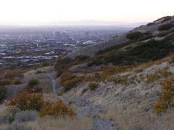
2.1 miles N of Salt Lake City, UtahBonneville Shoreline Trail is a great place for hiking, biking, and trail running. It stretches from North Salt Lake to Parley's Canyon. The trail follows the shoreline of ancient Lake Bonneville.
There are multiple trailheads to choose from. The City Creek trailhead (which is at the bottom of City Creek Canyon) can take you to North Salt Lake. Distance is about 5 miles.
You can also take the City Creek trailhead and follow the trail for about 7 miles into the foothills. It crosses paths with the Bobsled trail which is a very steep slope that will take you right into the city.
Cherry Springs
Pocatello, Idaho
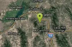
8.7 miles S of Pocatello, IdahoJust a short distance from Pocatello, the Cherry Springs Nature Area has thick green vegetation, an abundance of birds and viewing other wildlife. Take a picnic and a camera and head out on the trail. There are picnic tables along the trail.
Scout Mountain Campground
Pocatello, Idaho
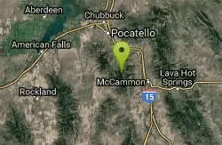
13.1 miles S of Pocatello, IdahoScout Mountain Campground sits high on Scout Mountain at about 6,900 feet, just 13 miles south of Pocatello, Idaho, and it's the natural basecamp for the whole Mink Creek recreation area, a beloved chunk of the Caribou-Targhee National Forest that serves as Pocatello's mountain backyard. Cool, forested and genuinely scenic, it's close enough for an after-work overnight and high enough to escape the summer heat of the Portneuf Valley below.
Trails are the reason most people come. A paved one-mile Scout Mountain Nature Trail loops the campground itself and leads to several overlooks, an easy, accessible walk that's rare at a mountain campground and perfect for an evening stroll or visitors with limited mobility. More ambitiously, the East Fork Mink Creek Trail begins right within the site and the Crestline Trail runs nearby, plugging the campground straight into a network popular for hiking, mountain biking, horseback riding and dirt biking.
The campground is well appointed. Single sites, double sites and one triple site come with picnic tables, campfire rings, utility serving tables, lantern posts and tent pads, and there's one large group site that can host up to 100 people, equipped with picnic and serving tables, grills, and a campfire ring with benches, which makes it a popular choice for reunions and scout groups. Both first-come, first-served and reservable sites are available. It's operated by Pinnacle Parks LLC under a special use permit with the Caribou-Targhee National Forest.
The surroundings sweeten the deal. Cherry Springs Nature Area lies less than six miles away, with its namesake spring, a stream for fishing, paved self-guided nature trails and picnic facilities. The Mink Creek Nordic Center is about five miles off, offering hiking and horseback trails in summer and groomed cross-country ski trails once the snow arrives, which keeps the drainage busy year-round even though the campground itself is a summer operation.
At 6,900 feet the season is short and the nights are cold even in midsummer, and mountain weather in the Bannock Range can turn quickly, so packing warm layers and rain gear is wise regardless of the forecast down in town.
Come with layers, plenty of water, bug spray for early summer, and a reservation if you want certainty on a summer weekend. Between the paved nature loop, trailheads starting at your tent, overlooks a short walk away and a whole trail network in the drainage, Scout Mountain is one of the best-value mountain campgrounds in southeastern Idaho.
Garden Creek Gap
McCammon, Idaho
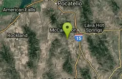
8.3 miles SW of McCammon, IdahoGarden Creek Gap is the defile Garden Creek cuts through as it flows toward Marsh Creek on the east side of the Bannock Range after draining a sizable chunk of territory on the west side of those mountains. Climbing nerd type people may have noticed it off to the west while traveling I-15 south of Pocatello. In the gap the stream has cut into a resistant layer of quartzite and thus exposed some rock climbing. If you do not rock climb but like to scramble, this has the best class 3, 3+ and 4 scrambling near Pocatello.


